 Slovenski INSPIRE metapodatkovni sistem
National General Map at 1 : 1 000 000 Scale
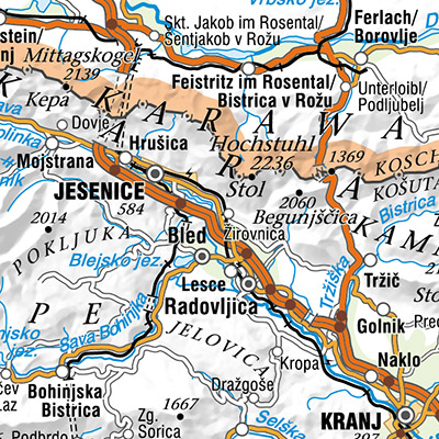
The National General Map at 1 : 1 000 000 Scale shows the entire territory of Slovenia on one sheet of A4 format. Layers: mathematical elements, settlements and objects, communications, relief, hydrography, land cover, boundaries and dividing line, geographical names. The dataset is used for "rough" geo-orientation and for the needs of large scale and thematic displaying.
|
|
Citation proposal
Geodetska uprava Republike Slovenije Geodetska uprava Republike Slovenije Surveying and Mapping Authority of the Republic of Slovenia . National General Map at 1 : 1 000 000 Scale. https://eprostor.gov.si/imps/srv/api/records/190a631e-5800-4495-a270-3bf8a893306a |
Simple
- Date ( Creation )
- 2008-12-31
- Date ( Revision )
- 2023-12-31
- Identifier
- SI.GURS.DPK1000 / fe1d479b-4bc9-425f-98e0-47357e46ccac
- Keywords
-
- Mathematical elements, settlements and objects, communications, relief, hydrography, land cover, boundaries and dividing line, geographical names, traffic network, imagery/base maps/land cover
- GEMET - INSPIRE themes, version 1.0 GEMET - INSPIRE themes, version 1.0 ( Theme )
-
- Hydrography
- Land cover
- Transport networks
- Use constraints
- Other restrictions
- Use limitation
- Splošni pogoji uporabe geodetskih podatkov: https://www.e-prostor.gov.si/dostopi/javni-dostop/?acitem=1821-1822
- Access constraints
- Other restrictions
- Spatial representation type
- Grid
- Denominator
- 1000000
- Metadata language
- Slovenian
- Topic category
-
- Imagery base maps earth cover
N
S
E
W
))
- Reference system identifier
- http://www.opengis.net/def/crs/EPSG/0/3794 / http://www.opengis.net/def/crs/EPSG/0/3794 /
- Distribution format
-
-
TIFF
( )
- Specification
-
TIFF
( )
- OnLine resource
- Spatial Portal
- OnLine resource
- Application Public Geodetic Data
- OnLine resource
- Application Public Geodetic Viewer
- Hierarchy level
- Dataset
Conformance result
- Date ( Publication )
- 2014-04-11
- Identifier
- SOP / 2014-01-0962
- Explanation
- Glej referenčno specifikacijo
- Pass
- true
Conformance result
- Date ( Publication )
- 2010-12-08
- Explanation
- See the referenced specification
- Pass
- true
- Statement
-
globalni geopotencialni model EGM96
digitalni model reliefa (detajlni 11,25'' x 18,75'' oz. grobi 90'' x 150'')
digitalni model gostote (detajlni 11,25'' x 18,75'' oz. grobi 90'' x 150'')
- 99 točk z merjenimi vrednostmi odklona navpičnice
- 4 605 točk anomalij težnosti
- 163 GPS/niveliranih točk
gmd:MD_Metadata
- File identifier
- 190a631e-5800-4495-a270-3bf8a893306a XML
- Metadata language
- Slovenian
- Hierarchy level
- Dataset
- Date stamp
- 2026-08-14T13:58:30
- Metadata standard name
- ISO 19115:2003/19139
- Metadata standard version
- 1.0
Overviews
thumbnail
large_thumbnail
Provided by

Views
190a631e-5800-4495-a270-3bf8a893306a
Access to the portal
Read here the full details and access to the data.
Associated resources
Not available