 Slovenski INSPIRE metapodatkovni sistem
National Border Record
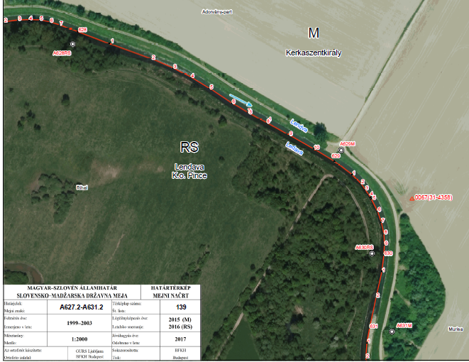
Database contains attributes about border points of a national border. These points are marked (physically on the field - border markers) and unmarked (breaking points). Border points indicate the national border of the Republic of Slovenia. Coordinates are defined in the coordinate system D48, Gauß-Krügerjev projection.
National Border Record is the fundamental register of the national border points. It contains data about country code, sector, type and position of the border mark, its label, coordinates in the D48/GK and D96/TM coordinate system and the neighbouring country reference system, the possible distance from the border line and the distance to the next border mark. National Border Record is established based on the Real Estate Cadastre Act - ZKN (Official Journal of RS, No. 54/2021).
Data from the National Border Record serves as a graphical representation of the national border, for the harmonization of Land Cadastre data and the Administrative Units Register with the national border.
|
|
Citation proposal
Geodetska uprava Republike Slovenije Geodetska uprava Republike Slovenije Surveying and Mapping Authority of the Republic of Slovenia . National Border Record. https://eprostor.gov.si/imps/srv/api/records/2270f9a6-178c-4a0e-989a-1b530b496722 |
INSPIRE
Identification
- File identifier
- 2270f9a6-178c-4a0e-989a-1b530b496722 XML
- Hierarchy level
- Dataset
- OnLine resource
- Spatial Portal
- OnLine resource
- Application Public Geoetic Data
- OnLine resource
- Application Public Geodetic Viewer
- Identifier
- SI.GURS.EDM / 3535a2ee-a531-4944-bf44-80ea8d799359
- Metadata language
- Slovenian
- Reference system identifier
- http://www.opengis.net/def/crs/EPSG/0/3912
- Reference system identifier
- http://www.opengis.net/def/crs/EPSG/0/3794 / http://www.opengis.net/def/crs/EPSG/0/3794 /
Classification of data and services
- Topic category
-
- Boundaries
Classification of data and services
Coupled resource
Coupled resource
Classification of data and services
Coupled resource
Coupled resource
Keywords
- GEMET - INSPIRE themes, version 1.0 GEMET - INSPIRE themes, version 1.0 ( Theme )
-
- Administrative units
Other keywords
- Keywords
-
- Administrative units, national border
Geographic coverage
))
Temporal reference
Temporal extent
Temporal extent
- Date ( Revision )
- 2008-01-31
- Date ( Creation )
- 2006-05-09
Quality and validity
- Lineage
- The source of the data is a list of coordinates which is approved by the governments of the two neighbouring countries. The coordinate list changes in the case of: new survey, periodical control, additional survey after adjustment of rivers, etc.
Spatial resolution
Spatial resolution (scale)
- Denominator
- 2000
- Denominator
- 5000
Spatial resolution (distance)
Md. maintenance
Coordinate Reference System
Encoding
- Format
- ESRI Shapefile
- Version
- 1.0
- Specification
- Character set
- 8859 Part 2
- Spatial representation type
- Vector
Conformity
Conformance result
- Date ( Publication )
- 2010-12-08
- Projection
- Codespace
- EU
- Explanation
- See the referenced specification
- Pass
- true
Conformance result
- Date ( Publication )
- 2021-04-09
- Identifier
- SOP / 2021-01-1047
- Explanation
- Glej referenčno specifikacijo
- Pass
- true
constraintsRelatedToAccessAndUse
Use limitation
useConstraint
Access constraints
Access constraints
constraintsRelatedToAccessAndUse
Use limitation
- Use limitation
- Splošni pogoji uporabe geodetskih podatkov: https://www.e-prostor.gov.si/dostopi/javni-dostop/?acitem=1821-1822
Access constraints
Access constraints
Responsible organization (s)
Responsible organization (s)
Metadata information
Point of contact
- Date stamp
- 2025-01-16T12:41:30
SDS
Conformance class 1: invocable
Access Point URL
Endpoint URL
Technical specification
Conformance class 2: interoperable
Coordinate reference system
Quality of Service
Access constraints
Limitation
Use constraints
Limitation
Responsible custodian
Contact for the resource
Conformance class 3: harmonized
Overviews
Provided by
