 Slovenski INSPIRE metapodatkovni sistem
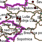
EuroBoundaryMap
The EuroBoundaryMap collection for Slovenia is part of the European collection at 1 : 100 000 scale, which homogenously covers 55 countries.
|
|
Citation proposal
Geodetska uprava Republike Slovenije Geodetska uprava Republike Slovenije Surveying and Mapping Authority of the Republic of Slovenia . EuroBoundaryMap. https://eprostor.gov.si/imps/srv/api/records/4747a05c-fb73-400b-9ca9-7685be836440 |
INSPIRE
Identification
- File identifier
- 4747a05c-fb73-400b-9ca9-7685be836440 XML
- Hierarchy level
- Dataset
- OnLine resource
- Spatial Portal
- Identifier
- SI.GURS.EBM / 84743dc5-193a-4403-b9a6-527c90890b4c
- Metadata language
- English
- Reference system identifier
- http://www.opengis.net/def/crs/EPSG/0/3035 / http://www.opengis.net/def/crs/EPSG/0/3035 /
Classification of data and services
- Topic category
-
- Boundaries
Classification of data and services
Coupled resource
Coupled resource
Classification of data and services
Coupled resource
Coupled resource
Keywords
- GEMET - INSPIRE themes, version 1.0 GEMET - INSPIRE themes, version 1.0 ( Theme )
-
- Administrative units
Other keywords
- Keywords
-
- Administrative units, borders
Geographic coverage
N
S
E
W
))
Temporal reference
Temporal extent
Temporal extent
- Date ( Creation )
- 2012-12-31
Quality and validity
- Lineage
- The collection includes geometry, names and codes of administrative and statistical units. The Surveying and Mapping Authority annually prepares and renews data for the area of the Republic of Slovenia. The main source are the Register of Spatial Units and National Border Record.
Spatial resolution
Spatial resolution (scale)
- Denominator
- 100000
Spatial resolution (distance)
Md. maintenance
Coordinate Reference System
Encoding
- Format
- ESRI Shapefile
- Version
- 1.0
- Specification
Conformity
Conformance result
- Date ( Publication )
- 2010-12-08
- Explanation
- See the referenced specification
Conformity
Conformance result
- Date ( Publication )
- 2010-12-08
- Explanation
- See the referenced specification
constraintsRelatedToAccessAndUse
Use limitation
useConstraint
Access constraints
Access constraints
constraintsRelatedToAccessAndUse
Use limitation
Access constraints
Access constraints
Responsible organization (s)
Responsible organization (s)
Metadata information
Point of contact
- Date stamp
- 2022-08-29T14:53:17
SDS
Conformance class 1: invocable
Access Point URL
Endpoint URL
Technical specification
Conformance class 2: interoperable
Coordinate reference system
Quality of Service
Access constraints
Limitation
Use constraints
Limitation
Responsible custodian
Contact for the resource
Conformance class 3: harmonized
Overviews
thumbnail

large_thumbnail
Provided by

Views
4747a05c-fb73-400b-9ca9-7685be836440
Access to the portal
Read here the full details and access to the data.
Associated resources
Not available