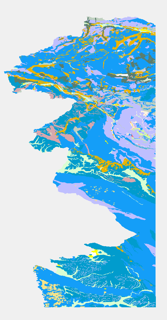
eENVplus GeoZS 100k surface Geologic Unit
The Basic Geological Map of Slovenia as a part of joint Basic Geological Map of SFR Yugoslavia presents lithological and stratigraphic characteristics of rocks, their relationships, age and other. It is a key to the understanding of the geology of Slovenia. It consists of 23 sheets at a scale of 1: 100,000.
|
|
Citation proposal
Geološki zavod Slovenije (2015) . eENVplus GeoZS 100k surface Geologic Unit. https://eprostor.gov.si/imps/srv/api/records/52535255-775d-4549-b6ea-9a6c0b9d50b0 |
INSPIRE
Identification
- File identifier
- 52535255-775d-4549-b6ea-9a6c0b9d50b0 XML
- Hierarchy level
- Dataset
- OnLine resource
- Identifier
- SI.GEOZS.EENVPLUS.100K.GU / 2ae26402-e7e6-4e62-85d3-aeef544c8080
- Metadata language
- English
- Reference system identifier
- http://www.opengis.net/def/crs/EPSG/0/4258
Classification of data and services
- Topic category
-
- Geoscientific information
Classification of data and services
Coupled resource
Coupled resource
Classification of data and services
Coupled resource
Coupled resource
Keywords
- GEMET - INSPIRE themes, version 1.0
-
- Geology
- ThIST - Italian Thesaurus of Earth Sciences (Version: Linked Data 1.0)
-
- construction materials
- sedimentary rocks
- sediments
- igneous rocks
- metamorphic rocks
- tectonic elements
- faults
- foliation
- geochronology
- stratigraphic units
- lithology
- lithostratigraphic unit
- relative age
- stratigraphy
- geology
- geologic maps
- depositional environment
- GEMET (version 3.1, 2012-07-20)
-
- natural environment
- geological process
- INSPIRE feature concept dictionary (Version: Linked Data 1.0)
-
- Geologic Event
- Geologic Feature
- Geologic Unit
- EARTh- Enviromental Applications Reference THesaurus (Version: Linked Data 1.5)
-
- *geolithological constituents*
- Spatial scope ( Theme )
-
- National
Other keywords
- Keywords
-
- eENVplus
- INSPIRE
- Keywords
-
- EP09
- Keywords ( Discipline )
-
- geologija
Geographic coverage
N
S
E
W
))
Temporal reference
Temporal extent
- Begin
- 2015-01-01
- End
- 2016-12-31
Temporal extent
- Date ( Publication )
- 2015-01-01
- Date ( Revision )
- 2015-01-01
- Date ( Creation )
- 2015-01-01
Quality and validity
- Lineage
- percentCoverage=100;geometricHarmonization=100;thematicHarmonization=100;geometricHarmonizationDescription;thematicHarmonizationDescription;
Spatial resolution
Spatial resolution (scale)
- Denominator
- 1000000
Spatial resolution (distance)
Md. maintenance
Coordinate Reference System
Encoding
- Format
- WFS
- Version
- 1.1.0
- Spatial representation type
- Vector
Conformity
Conformance result
- Date ( Publication )
- 2010-12-08
- Explanation
- See the referenced specification
- Pass
- false
Conformity
Conformance result
- Date ( Publication )
- 2010-12-08
- Explanation
- See the referenced specification
- Pass
- false
constraintsRelatedToAccessAndUse
Use limitation
useConstraint
Access constraints
Access constraints
constraintsRelatedToAccessAndUse
Use limitation
Access constraints
Access constraints
Responsible organization (s)
Owner
Point of contact
Custodian
Responsible organization (s)
Owner
Point of contact
Custodian
Metadata information
Point of contact
- Date stamp
- 2022-12-09T15:07:24
SDS
Conformance class 1: invocable
Access Point URL
Endpoint URL
Technical specification
Conformance class 2: interoperable
Coordinate reference system
Quality of Service
Access constraints
Limitation
Use constraints
Limitation
Responsible custodian
Contact for the resource
Conformance class 3: harmonized
Overviews

large_thumbnail
Provided by

Views
52535255-775d-4549-b6ea-9a6c0b9d50b0
Access to the portal
Read here the full details and access to the data.
Associated resources
Not available
 Slovenski INSPIRE metapodatkovni sistem