 Slovenski INSPIRE metapodatkovni sistem
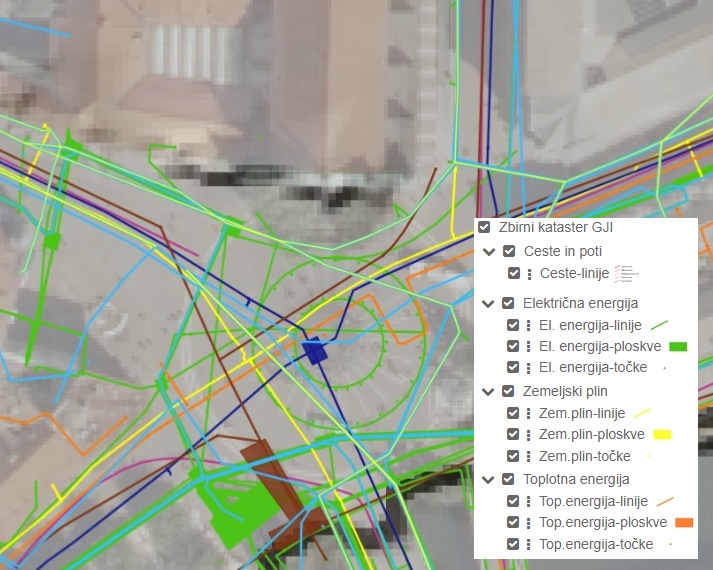
Consolidated Cadastre of Public Infrastructure
The Consolidated Cadastre of Public Infrastructure is a register in which facilities of public infrastructure and network connection points of the public communications network are recorded. For each public infrastructure facility, data are maintained on the type and category of the facility, its location, identification data, and information on the operator of the facility. For each network connection point, identification data, location data, information on the minimum capacity of the network connection point, and information on the owner of the network connection point are recorded. All operators of public infrastructure and owners of network connection points are required to submit the relevant data to the Consolidated Cadastre of Public Infrastructure. Public access to data from the Consolidated Cadastre of Public Infrastructure is ensured for all users.
The primary purpose of establishing the Consolidated Cadastre of Public Infrastructure is to provide an overview of spatial occupancy by public infrastructure facilities and public communications network connection points across the entire territory of the country. This will, in the future, enable more efficient spatial planning, safer implementation of interventions in space, and more economical management of infrastructure assets.
|
|
Citation proposal
Geodetska uprava Republike Slovenije Geodetska uprava Republike Slovenije (2005) . Consolidated Cadastre of Public Infrastructure. https://eprostor.gov.si/imps/srv/api/records/923dfad8-6172-4ffa-be2a-4436e26a8d78 |
Simple
- Date ( Creation )
- 2005-09-27
- Date ( Publication )
- 2005-10-26
- Identifier
- SI.GURS.KGI / 3818bc44-391c-43e4-93da-67f7256ab22d
- Maintenance and update frequency
- Continual
- Maintenance note
- Keywords
-
- Prometna infrastruktura, energetska infrastruktura, komunalna infrastruktura, vodna infrastruktura, elektronske komunikacije, objekti za opazovanje naravnih pojavov in naravnih virov, omrežne priključne točke javnega komunikacijskega omrežja
- Spatial scope Spatial scope ( Theme )
-
- National
- GEMET - INSPIRE themes, version 1.0 GEMET - INSPIRE themes, version 1.0 ( Theme )
-
- Transport networks
- Utility and governmental services
- Production and industrial facilities
- Area management/restriction/regulation zones and reporting units
- theme.high-value-dataset-category.rdf theme.high-value-dataset-category.rdf ( Theme )
-
- Mobility
- Keywords ( Theme )
-
- Podatki velike vrednosti
- Access constraints
- Other restrictions
- Use limitation
- No limitations
- Use limitation
- Confidentiality of public authority procedures
- Use constraints
- Other restrictions
- Use limitation
- Splošni pogoji uporabe geodetskih podatkov: https://www.e-prostor.gov.si/dostopi/javni-dostop/?acitem=1821-1822
- Use limitation
- Podatki so dostopni pod Creative Commons - Attribution 4.0 International (CC BY 4.0) licenco. (https://creativecommons.org/licenses/by/4.0)
- Spatial representation type
- Vector
- Denominator
- 500
- Denominator
- 1000
- Denominator
- 2880
- Denominator
- 5000
- Denominator
- 10000
- Metadata language
- Slovenian
- Topic category
-
- Utilities communication
))
- Reference system identifier
- http://www.opengis.net/def/crs/EPSG/0/3794
- Distribution format
-
-
ESRI Shapefile
(1.0 )
- Specification
-
CSV
( )
- Specification
-
ESRI Shapefile
(1.0 )
- OnLine resource
- Portal Prostor
- OnLine resource
- Aplikacija JGP za prenos brezplačnih podatkov
- OnLine resource
- Aplikacija Javni vpogled
- OnLine resource
-
GURS - javni spletni kartografski servisi (WMS) - vektorski podatki
GURS - javni spletni kartografski servisi (WMS) - vektorski podatki
- OnLine resource
- INSPIRE - Cestni odseki - ATOM spletna storitev prenosa podatkov
- OnLine resource
-
INSPIRE cestni odseki WFS
INSPIRE cestni odseki WFS
- OnLine resource
-
tn-ro:TN.RoadTransportNetwork.RoadLink
RoadLink default Style
- OnLine resource
-
INSPIRE elektroenergetsko omrežje WFS
INSPIRE elektroenergetsko omrežje WFS
- OnLine resource
-
us-net-el:US.ElectricityNetwork
Electricity Network
- OnLine resource
-
INSPIRE kanalizacijsko omrežje WFS
INSPIRE kanalizacijsko omrežje WFS
- OnLine resource
-
us-net-sw:US.SewerNetwork
Sewer Network
- OnLine resource
-
INSPIRE komunalne in javne storitve WFS
INSPIRE komunalne in javne storitve WFS
- OnLine resource
- INSPIRE - Letališča - ATOM spletna storitev prenosa podatkov
- OnLine resource
-
tn-a:TN.AirTransportNetwork.AerodromeArea
Aerodrome Area Default Style
- OnLine resource
-
tn-a:TN.AirTransportNetwork.ApronArea
Apron Area Default Style
- OnLine resource
-
tn-a:TN.AirTransportNetwork.RunwayArea
Runway Area Default Style
- OnLine resource
-
INSPIRE pristaniška območja WFS
Port Area Default Style
- OnLine resource
-
tn-w:TN.WaterTransportNetwork.PortArea
Port Area Default Style
- OnLine resource
-
INSPIRE toplotno omrežje WFS
Thermal Pipe
- OnLine resource
-
us-net-th:US.ThermalNetwork
Thermal Network
- OnLine resource
-
INSPIRE vodovodno omrežje WFS
Water Pipe
- OnLine resource
-
us-net-wa:US.WaterNetwork
Water Network
- OnLine resource
-
INSPIRE železnice WFS
RailwayLink
- OnLine resource
-
tn-ra:TN.RailTransportNetwork.RailwayLink
Railway Link Default Style
- Hierarchy level
- Dataset
Conformance result
- Date ( Publication )
- 2010-12-08
- Projection
- Codespace
- EU
- Explanation
- Glej referenčno specifikacijo
- Pass
- true
Conformance result
- Date ( Publication )
- 2021-12-22
- Identifier
- SOP / 2021-01-3971
- Explanation
- Glej referenčno specifikacijo
- Pass
- true
Conformance result
- Date ( Publication )
- 2022-10-11
- Identifier
- SOP / 2022-01-3081
- Explanation
- Glej referenčno specifikacijo
- Pass
- true
Conformance result
- Date ( Publication )
- 2004-02-02
- Identifier
- SOP / 2004-01-0415
- Explanation
- Glej referenčno specifikacijo
- Pass
- true
Conformance result
- Date ( Publication )
- 2023-07-21
- Identifier
- SOP / 2023-01-2507
- Explanation
- Glej referenčno specifikacijo
- Pass
- true
Conformance result
- Date ( Publication )
- 2006-04-04
- Identifier
- SOP / 2006-01-1443
- Explanation
- Glej referenčno specifikacijo
- Pass
- true
Conformance result
- Date ( Publication )
- 2011-04-15
- Identifier
- SOP / 2011-01-1304
- Explanation
- Glej referenčno specifikacijo
- Pass
- true
Conformance result
- Date ( Publication )
- 2005-05-09
- Identifier
- SOP / 2005-01-1880
- Explanation
- Glej referenčno specifikacijo
- Pass
- true
Conformance result
- Date ( Publication )
- 2009-01-19
- Identifier
- SOP / 2009-01-0139
- Explanation
- Glej referenčno specifikacijo
- Pass
- true
Conformance result
- Date ( Publication )
- 2007-12-24
- Identifier
- SOP / 2007-01-5983
- Explanation
- Glej referenčno specifikacijo
- Pass
- true
Conformance result
- Date ( Publication )
- 2022-10-14
- Identifier
- SOP / 2022-01-3113
- Explanation
- glej referenčno specifikacijo
- Pass
- true
Conformance result
- Date ( Publication )
- 1997-08-08
- Identifier
- SOP / 1997-01-2576
- Explanation
- glej referenčno specifikacijo
- Pass
- true
Conformance result
- Date ( Publication )
- 2012-12-21
- Identifier
- SOP / 2012-01-3940
- Explanation
- glej referenčno specifikacijo
- Pass
- true
Conformance result
- Date ( Publication )
- 2018-02-28
- Identifier
- SOP / 2018-01-0543
- Explanation
- glej referenčno specifikacijo
- Pass
- true
Conformance result
- Date ( Publication )
- 2008-08-08
- Identifier
- SOP / 2008-01-3595
- Explanation
- glej referenčno specifikacijo
- Pass
- true
Conformance result
- Date ( Publication )
- 2014-03-07
- Identifier
- SOP / 2014-01-0538
- Explanation
- glej referenčno specifikacijo
- Pass
- true
Conformance result
- Date ( Publication )
- 2017-10-27
- Identifier
- SOP / 2017-01-2879
- Explanation
- glej referenčno specifikacijo
- Pass
- true
Conformance result
- Date ( Publication )
- 2018-09-07
- Identifier
- SOP / 2018-01-2919
- Explanation
- glej referenčno psecifikacijo
- Pass
- true
Conformance result
- Date ( Publication )
- 2016-03-25
- Identifier
- SOP / 2016-01-0891
- Explanation
- glej referenčno specifikacijo
- Pass
- true
Conformance result
- Date ( Publication )
- 2022-12-21
- Projection
- Codespace
- EU
- Explanation
- Glej referenčni predpis: http://data.europa.eu/eli/reg_impl/2023/138/oj
- Pass
- true
- Statement
- Vir: Katastri gospodarske komunalne infrastrukture, ki jih vodijo lokalne skupnosti, resorna ministrstva ali pristojne gospodarske javne službe. Vir podatkov o položaju so: geodetska izmera, geodetska izmera po zasutju, analogni geodetski načrt (merila 1:500, 1:1000, 1:2880, 1:5000, 1:10000 ali manj), projekt za pridobitev gradbenega dovoljenja - PGD, projekt za izvedbo - PZI, fotogrametrični zajem s pomočjo stereoparov (CAS, PAS), DOF 5, GPS, kartografske podlage merila 1:25000 ali manj, drugo. Položajna natančnost se v zbirnem katastru vodi za vsak objekt posebej in je določena s šifrantom. Vsi objekti so opisani v izmenjevalnem formatu. Polnjenje zbirke je v večji meri odvisno od upravljavcev (občine, pristojna ministrstva, operaterji elektronskih komunikacij, itd.), in operaterjev omrežnih priključnih točk, katerim zakonodaja nalaga zagotavljanje posredovanja podatkov v zbirni kataster. Logična usklajenost posameznega objekta GJI se preverja pri kontroli uvoza in se ocenjuje, da je 99%. Podatkovni niz pokriva območje celotne države. Celotna popolnost je različna glede na posamezni objektni tip (tematiko).
gmd:MD_Metadata
- File identifier
- 923dfad8-6172-4ffa-be2a-4436e26a8d78 XML
- Metadata language
- Slovenian
- Hierarchy level
- Dataset
- Date stamp
- 2026-05-28T09:16:44
- Metadata standard name
- ISO 19115:2003/19139
- Metadata standard version
- 1.0
Overviews
Provided by
