 Slovenski INSPIRE metapodatkovni sistem
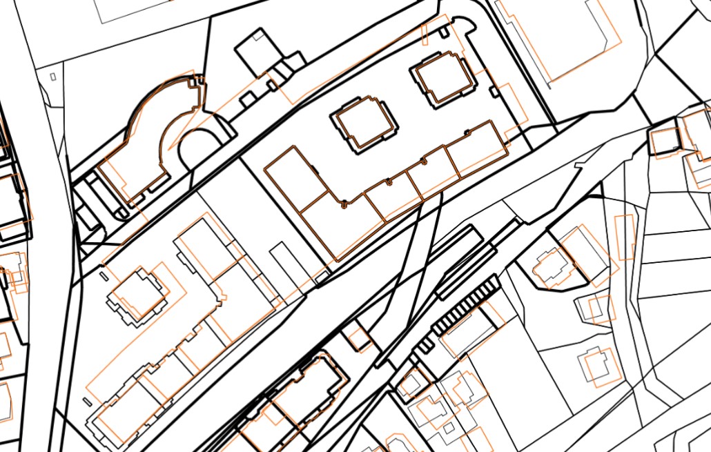
Realestate cadastre
The realestate cadastre is designed as an official record of data on plots, buildings and parts of buildings, which enables the registration of real rights on them (or their parts) in the land register. The realestate cadastre is the fundamental record of the Republic of Slovenia's data on the location, shape, physical and other characteristics of plots, buildings and parts of buildings, which shows the actual state of real estate.
The realestate cadastre consists of registered data on plots of land, buildings and parts of buildings, as well as a collection of documents. The entered data on plots, buildings and parts of buildings, as well as the collection of documents, are kept permanently. The realestate cadastre contains data on the areas of building rights and data on the areas of enforcement of servitudes or illegal servitudes.
In the realestate cadastre, as data layers, there are also data on cadastral municipalities, actual land use, areas of land creditworthiness in the layer of land creditworthiness areas and a layer of temporary entries (areas of building rights and data on the area of enforcement of easement in rem or illegal easement in rem before decided by the land register).
|
|
Citation proposal
Geodetska uprava Republike Slovenije Geodetska uprava Republike Slovenije . Realestate cadastre. https://eprostor.gov.si/imps/srv/api/records/9a8fd241-9162-407c-94e7-c98e05766881 |
Simple
- Date ( Creation )
- 2022-04-04
- Identifier
- SI.GURS.KN / affacb68-fbc3-4a1e-9fae-02cfecb46882
- Maintenance and update frequency
- Continual
- Maintenance note
- GEMET - INSPIRE themes, version 1.0 GEMET - INSPIRE themes, version 1.0 ( Theme )
-
- Buildings
- Cadastral parcels
- Spatial scope Spatial scope ( Theme )
-
- National
- Keywords
-
- Cadastral parcels
- Keywords
-
- Buildings
- Podatki velike vrednosti High value dataset Podatki velike vrednosti ( Theme )
-
- High value dataset
- theme.high-value-dataset-category.rdf theme.high-value-dataset-category.rdf ( Theme )
-
- Geospatial
- Buildings
- Cadastral parcels
- Access constraints
- Other restrictions
- Use limitation
- No limitations
- Use constraints
- Other restrictions
- Use limitation
- Splošni pogoji uporabe geodetskih podatkov: https://www.e-prostor.gov.si/dostopi/javni-dostop/?acitem=1821-1822
- Use limitation
- Podatki so dostopni pod Creative Commons - Attribution 4.0 International (CC BY 4.0) licenco. (https://creativecommons.org/licenses/by/4.0)
- Spatial representation type
- Vector
- Metadata language
- Slovenian
- Character set
- UTF8
- Topic category
-
- Planning cadastre
))
- Reference system identifier
- http://www.opengis.net/def/crs/EPSG/0/3794
- Distribution format
-
-
ESRI Shapefile
(1.0 )
- Specification
-
ESRI Shapefile
(1.0 )
- OnLine resource
-
Real Estate Cadastre WFS
Provides direct web-based access to official vector spatial data on land parcels, buildings, and building parts in Slovenia.
- OnLine resource
-
Spatial Portal
Central portal for access to reference spatial data, applications and services of the Surveying and Mapping Authority of the Republic of Slovenia.
- OnLine resource
-
Public Surveying Data (JGP)
The Public Surveying Data (JGP) application is intended for downloading free data from the Surveying and Mapping Authority from the overhauled distribution system.
- OnLine resource
-
Public Access (JV)
Public Access (JV) is an application that allows the user to view descriptive and graphical data from the Surveying and Mapping Authority and certain other managers.
- OnLine resource
-
INSPIRE cadastral parcels WMS
Provides direct web-based access to standardized cartographic layers for visualizing land parcel boundaries in Slovenia, compliant with the INSPIRE Directive.
- OnLine resource
-
INSPIRE cadastral parcels WFS
Provides direct access to official vector spatial data on land parcels in Slovenia (geometries and unique identifiers) from the Real Estate Cadastre, compliant with the INSPIRE Directive.
- OnLine resource
-
INSPIRE buildings WFS
Provides direct access to official vector spatial data on buildings in Slovenia, compliant with the INSPIRE Directive.
- OnLine resource
-
INSPIRE buildings WMS
Provides direct web-based access to standardized cartographic layers for visualizing building footprints in Slovenia, compliant with the INSPIRE Directive.
- OnLine resource
-
INSPIRE cadastral parcels WFS
Provides direct access to official vector spatial data on land parcels in Slovenia (geometries and unique identifiers) from the Real Estate Cadastre, compliant with the INSPIRE Directive.
- OnLine resource
-
INSPIRE cadastral parcels WMS
Provides direct web-based access to standardized cartographic layers for visualizing land parcel boundaries in Slovenia, compliant with the INSPIRE Directive.
- Hierarchy level
- Dataset
Conformance result
- Date ( Publication )
- 2021-04-09
- Identifier
- SOP / 2021-01-1047
- Explanation
- Glej referenčni predpis
- Pass
- true
Conformance result
- Date ( Publication )
- 2021-07-19
- Identifier
- SOP / 2021-01-2541
- Explanation
- Glej referenčni predpis
- Pass
- true
Conformance result
- Date ( Publication )
- 2021-07-19
- Identifier
- SOP / 2021-01-2542
- Explanation
- Glej referenčni predpis
- Pass
- true
Conformance result
- Date ( Publication )
- 2021-07-19
- Identifier
- SOP / 2021-01-2543
- Explanation
- Glej referenčni predpis
- Pass
- true
Conformance result
- Date ( Publication )
- 2021-07-19
- Identifier
- SOP / 2021-01-2544
- Explanation
- Glej referenčni predpis
- Pass
- true
Conformance result
- Date ( Publication )
- 2021-09-01
- Identifier
- SOP / 2021-01-2810
- Explanation
- Glej referenčni predpis
- Pass
- true
Conformance result
- Date ( Publication )
- 2021-09-24
- Identifier
- SOP / 2021-01-2928
- Explanation
- Glej referenčni predpis
- Pass
- true
Conformance result
- Date ( Publication )
- 2021-11-05
- Identifier
- SOP / 2021-01-3424
- Explanation
- Glej referenčni predpis
- Pass
- true
Conformance result
- Date ( Publication )
- 2021-11-05
- Identifier
- SOP / 2021-01-3427
- Explanation
- Glej referenčni predpis
- Pass
- true
Conformance result
- Date ( Publication )
- 2021-12-15
- Identifier
- SOP / 2021-01-3892
- Explanation
- Glej referenčni predpis
- Pass
- true
Conformance result
- Date ( Publication )
- 2022-03-23
- Identifier
- SOP / 2022-01-0786
- Explanation
- Glej referenčni predpis
- Pass
- true
Conformance result
- Date ( Publication )
- 2022-12-21
- Projection
- Codespace
- EU
- Explanation
- See the reference regulation: http://data.europa.eu/eli/reg_impl/2023/138/oj
- Pass
- true
Conformance result
- Date ( Publication )
- 2010-12-08
- Projection
- Codespace
- EU
- Explanation
- See the referenced specification
- Pass
- true
- Statement
-
When the records of the former land cadastre were established, the source of data for the parcels were land cadastral plans of various scales. The relative accuracy between objects depends mainly on the scale of the basic cadastral plans and corresponds to the graphic accuracy (0.2 mm × scale of the plan). The absolute accuracy depends on the type of cadastre, the method of measurement and the scale of the cadastral plan.
The source of data for buildings, when the records of the former cadastre of buildings were established, were photogrammetric survey, field survey, data acquisition from other records. Positional accuracy depends on the coordinate capture method; field measurement: 0-12 cm, photogrammetric survey: 0-50 cm, from basic topographic plans (TTN): 0-150 cm, from graphic data of the land cadastre (ZK) over 150 cm, field survey without connection to the grid: over 150 cm, measurement of the building site: 0-12 cm, data capture from the register of spatial units (RPE): 0-150 cm.
The maintenance of the real estate cadastre takes place through individual procedures for recording data changes with various types of cadastral procedures, which are carried out on the basis of the initiative of various entities (investors, owners, users, administrators, states, municipalities, etc.), by official duty, on the basis of final court decisions and other acts and on the basis of changes from related databases (register of spatial units, register of addresses, state border records, land registry, central population register, business register, records of actual land use, PIS,...).
The real estate cadastre is established in accordance with the Real Estate Cadastre Act - ZKN. The data in digital format is established for the entire territory of the Republic of Slovenia. The database is maintained in the national ETRS coordinate system D96/TM.
gmd:MD_Metadata
- File identifier
- 9a8fd241-9162-407c-94e7-c98e05766881 XML
- Metadata language
- Slovenian
- Character set
- MD_CharacterSetCode_utf8
- Hierarchy level
- Dataset
- Date stamp
- 2026-07-16T12:32:03
- Metadata standard name
- ISO 19115:2003/19139
- Metadata standard version
- 1.0
Overviews
Provided by
