 Slovenski INSPIRE metapodatkovni sistem
National Maps
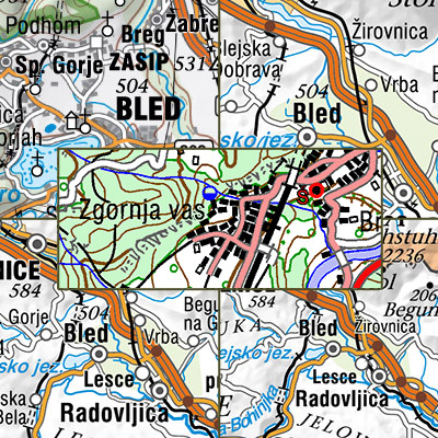
National Maps are cartographically processed topographic data, which are managed in the national spatial coordinate reference system and are presented in the national cartographic projection.
National Maps are managed in digital format. National maps for the territory of the Republic of Slovenia are: - National Topographic Map at a scale 1 : 50 000,
- National General Maps at a scales 1 : 250 000, 1 : 500 000, 1 : 750 000 and 1 : 1 000 000,
- maps produced on the basis of an agreement or contract with the public authorities of other countries or international civil institutions and organizations and are showing the territory of the Republic of Slovenia.
|
|
Citation proposal
Geodetska uprava Republike Slovenije Geodetska uprava Republike Slovenije Surveying and Mapping Authority of the Republic of Slovenia . National Maps. https://eprostor.gov.si/imps/srv/api/records/ee5819e6-425c-4408-831a-ee60a729f2a1 |
INSPIRE
Identification
- File identifier
- ee5819e6-425c-4408-831a-ee60a729f2a1 XML
- Hierarchy level
- Dataset
- OnLine resource
-
Portal Spatial
Central portal for access to reference spatial data, applications and services of the Surveying and Mapping Authority of the Republic of Slovenia.
- OnLine resource
-
Public Surveying Data (JGP)
The Public Surveying Data (JGP) application is intended for downloading free data from the Surveying and Mapping Authority from the overhauled distribution system.
- OnLine resource
-
Public Access (JV)
Public Access (JV) is an application that allows the user to view descriptive and graphical data from the Surveying and Mapping Authority and certain other managers.
- Identifier
- SI.GURS.DK / 5f33999e-f94e-4ab1-99ef-454e4bb419a4
- Metadata language
- Slovenian
- Reference system identifier
- http://www.opengis.net/def/crs/EPSG/0/3912
- Reference system identifier
- http://www.opengis.net/def/crs/EPSG/0/3794
Classification of data and services
- Topic category
-
- Imagery base maps earth cover
Classification of data and services
Coupled resource
Coupled resource
Classification of data and services
Coupled resource
Coupled resource
Keywords
- GEMET - INSPIRE themes, version 1.0 GEMET - INSPIRE themes, version 1.0 ( Theme )
-
- Land cover
- Transport networks
- Hydrography
- Prostorski obseg Prostorski obseg Spatial scope ( Theme )
Other keywords
- Keywords
-
- Hydrography, transport network, land cover, buildings, images/base maps/land cover
Geographic coverage
))
Temporal reference
Temporal extent
Temporal extent
- Date ( Creation )
- 2016-12-31
- Date ( Revision )
- 2017-12-31
Quality and validity
- Lineage
- National Maps are being created in different ways. They are maintained in digital form. The period of renewal depends on a sort of map.
Spatial resolution
Spatial resolution (scale)
- Denominator
- 50000
- Denominator
- 250000
- Denominator
- 500000
- Denominator
- 750000
- Denominator
- 1000000
Spatial resolution (distance)
Md. maintenance
Coordinate Reference System
Encoding
- Format
- TIFF
- Version
- Specification
- Format
- ESRI Shapefile
- Version
- Specification
- Character set
- 8859 Part 2
- Spatial representation type
- Grid
Conformity
Conformance result
- Date ( Publication )
- 2010-12-08
- Explanation
- See the referenced specification
- Pass
- false
Conformance result
- Date ( Publication )
- 2014-04-11
- Identifier
- SOP / 2014-01-0962
- Explanation
- Glej referenčno specifikacijo
- Pass
- true
Conformity
Conformance result
- Date ( Publication )
- 2010-12-08
- Explanation
- See the referenced specification
- Pass
- false
Conformance result
- Date ( Publication )
- 2014-04-11
- Identifier
- SOP / 2014-01-0962
- Explanation
- Glej referenčno specifikacijo
- Pass
- true
constraintsRelatedToAccessAndUse
Use limitation
useConstraint
Access constraints
Access constraints
constraintsRelatedToAccessAndUse
Use limitation
- Use limitation
- Splošni pogoji uporabe geodetskih podatkov: https://www.e-prostor.gov.si/dostopi/javni-dostop/?acitem=1821-1822
Access constraints
Access constraints
Responsible organization (s)
Responsible organization (s)
Metadata information
Point of contact
- Date stamp
- 2026-08-14T14:42:58
SDS
Conformance class 1: invocable
Access Point URL
Endpoint URL
Technical specification
Conformance class 2: interoperable
Coordinate reference system
Quality of Service
Access constraints
Limitation
Use constraints
Limitation
Responsible custodian
Contact for the resource
Conformance class 3: harmonized
Overviews
Provided by
