 Slovenski INSPIRE metapodatkovni sistem
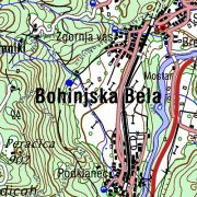
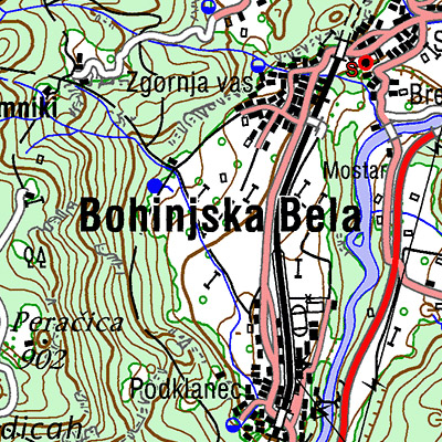
National Topographic Map at 1 : 50 000 Scale
The territory of Republic of Slovenia covers 58 sheets of the National Topographic Map at 1 : 50 000 scale. Raster images with DTK 50 sheets are provided. Besides the joined color layer also eight geolocated raster layers are provided:
- settlements, communications, names
- border of roads and rocks
- roads in relation to road surface, traffic surfaces
- relief - contour lines
- water
- vegetation
- UTM network
- relief shadows.
From year 2017 the map is available also as seamless cartographic raster layer. Georeferenced raster image is written in TIFF + TFW files in resolution 4 m (317.5 dpi) and cut into 99 rectangle tiles in 9 rows and 11 columns.
DTK 50 is intended for spatial planning, for orientation on the field, as base for other themes, as a source for making other maps. Raster and vector data are available as free data.
|
|
Citation proposal
Geodetska uprava Republike Slovenije Geodetska uprava Republike Slovenije Surveying and Mapping Authority of the Republic of Slovenia . National Topographic Map at 1 : 50 000 Scale. https://eprostor.gov.si/imps/srv/api/records/efa028d4-60c9-4489-a1ef-78a9fbb81699 |
Simple
- Date ( Creation )
- 2005-12-31
- Date ( Revision )
- 2025-12-31
- Identifier
- SI.GURS.DTK50 / ca7de3a2-7484-4453-872d-13873163794c
- Keywords
-
- topography, settlements, roads, names, relief, hydrography, maps, traffic network, imagery/base maps/land cover
- GEMET - INSPIRE themes, version 1.0 GEMET - INSPIRE themes, version 1.0 ( Theme )
-
- Hydrography
- Transport networks
- Land cover
- Access constraints
- Other restrictions
- Use limitation
- No limitations
- Use constraints
- Other restrictions
- Use limitation
- Splošni pogoji uporabe geodetskih podatkov: https://www.e-prostor.gov.si/dostopi/javni-dostop/?acitem=1821-1822
- Denominator
- 50000
- Metadata language
- Slovenian
- Topic category
-
- Imagery base maps earth cover
))
- Reference system identifier
- http://www.opengis.net/def/crs/EPSG/0/3794 / http://www.opengis.net/def/crs/EPSG/0/3794 /
- Distribution format
-
-
TIFF
( )
- Specification
-
TIFF
( )
- OnLine resource
- Spatial Portal
- OnLine resource
- Application Public Geodetic Data
- OnLine resource
- Application Public Geodetic Viewer
- Hierarchy level
- Dataset
Conformance result
- Date ( Publication )
- 2010-12-08
- Explanation
- See the referenced specification
Conformance result
- Date ( Publication )
- 2014-04-11
- Identifier
- SOP / 2014-01-0962
- Explanation
- Glej referenčno specifikacijo
- Pass
- true
- Statement
- Sources of DTK 50 are: Topographic Map at 1 : 50 000 Scale (VGI), data of cyclical aerial survey of Slovenia, field survey. National Topographic Map at 1 : 50 000 Scale was made during the period of 1999 - 2005. Reambulation of DTK 50 sheets takes place from 2006 For the renewal, data of cyclical aerial survey, lidar data, field data survey and other relevant available data are used. National coordinate system D48, Gauß-Krügerjev projection. New national coordinate system D96, transverse Mercator projection (TM). The data set covers the entire country territory. The positioning accuracy is 20 m.
gmd:MD_Metadata
- File identifier
- efa028d4-60c9-4489-a1ef-78a9fbb81699 XML
- Metadata language
- Slovenian
- Hierarchy level
- Dataset
- Date stamp
- 2026-02-06T08:22:08
- Metadata standard name
- ISO 19115:2003/19139
- Metadata standard version
- 1.0
Overviews
Provided by
