 TEST - Slovenski INSPIRE metapodatkovni sistem
Keyword
Boundaries
3 record(s)
Type of resources
Categories
INSPIRE themes
Keywords
Contact for the resource
Representation types
Scale
-
The Register of Spatial Units is an integrated database with graphical and attribute data on addresses and spatial units (spatial districts, settlements, municipalities, postal districts, administrative units, statistical regions, school districts, immediate parts of municipalities (urban districts, local communities, rural districts), the regional surveying and mapping authorities, units for Slovenian parliamentary elections, units for local elections, streets and house numbers (addresses). Register contains information about type of object, identification number, name, border and area, dates and geolocation. The register includes information about street names and house numbers with their geolocation.
-

The EuroBoundaryMap collection for Slovenia is part of the European collection at 1 : 100 000 scale, which homogenously covers 55 countries.
-

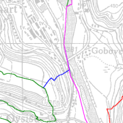
Database contains attributes about border points of a national border. These points are marked (physically on the field - milestones) and unmarked (breaking points). Border points indicate the national border of the Republic of Slovenia. Coordinates are defined in the coordinate system D48, Gauß-Krügerjev projection. National Border Record is the fundamental register of the national border points. It contains data about country code, sector, type and position of the border mark, its label, coordinates in the GK coordinate system and the neighbouring country reference system, the possible distance from the border line and the distance to the next milestone. National Border Record is established based on the Real Estate Registration Law - ZEN (Official Journal of RS, No. 47/2006, 65/2007 - US Decision and 55/2013 - ZUKD-1B). Data from the National Border Record serves as a graphical representation of the national border, for the harmonization of Land Cadastre data and the Administrative Units Register with the national border.