 TEST - Slovenski INSPIRE metapodatkovni sistem
Type
dataset
218 record(s)
Type of resources
Categories
INSPIRE themes
Keywords
Contact for the resource
Formats
Representation types
Scale
Resolution
-
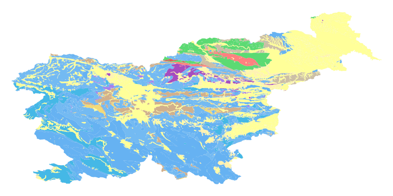
The harmonized geological map of Slovenia at a scale of 1:1,000,000 is a simplified version of the 1:250,000 scale Geological Map of Slovenia (Buser, 2009). The latter was compiled from the Basic Geological Map of Slovenia at a scale of 1: 100,000 (contributed by various authors between 1960's and 1980's and updated with new information gathered by S. Buser). The map is basically lithostratigraphic. The two layers incorporated in the map are lithostratigraphic units and major faults. The faults depicted on the map were selected using two criteria; regional extent and tectonic importance. The map presented here was edited specifically for the purpose of the OneGeology-Europe project by M. Bavec, M. Novak, M. Poljak, M. Trajanova and D. Skaberne.
-
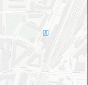
The layer keeps track of the locations of stations and public passenger transport stops.
-

Agricultural and Forestry Land Use Database is an official national database of agricultural and forestry land use in Slovenia. Basic element in the database is a land use polygon which represent the unique part of land with the same land use.
-

-

The National General Map at 1: 250 000 Scale shows the entire territory of Slovenia on one sheet of A0 format. Layers: mathematical elements, settlements and objects, communications, relief, hydrography, land cover, boundaries and dividing line, geographical names. The map is also available in printed form. The data set is used for "rough" orientation in the space and for the needs of large scale and thematic displaying.
-

The National General Map at 1 : 750 000 Scale shows the entire territory of Slovenia on one sheet of A3 format. Layers: mathematical elements, settlements and objects, communications, relief, hydrography, land cover, boundaries and dividing line, geographical names. The data set is used for "rough" orientation in the space and for the needs of large scale and thematic displaying.
-
-
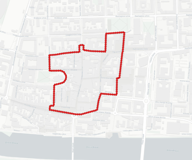
The layer keeps track of the Maister city minivan operational area, which is located in Maribor city center.
-
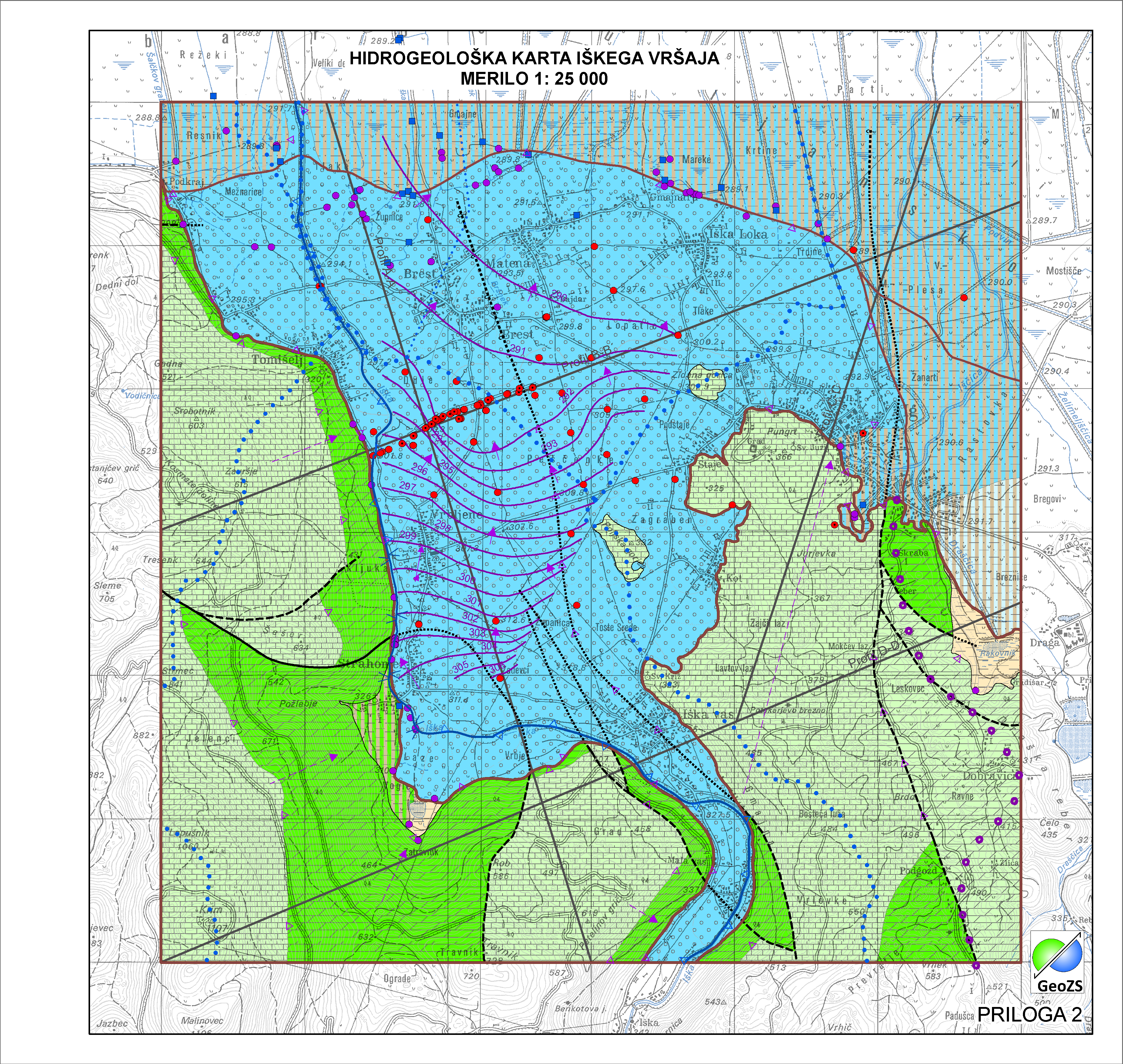
Data of Geological map were reclassified into classes of IAH classification on the base of hydrogeological characteristics. IAH classification is based on description of the hydrogeological units. Firstly, based on extensiveness and productivity and secondly on type of porosity. The purpose is to provide assistance to the strategy of groundwater exploitation as to protection and water resources management.
-
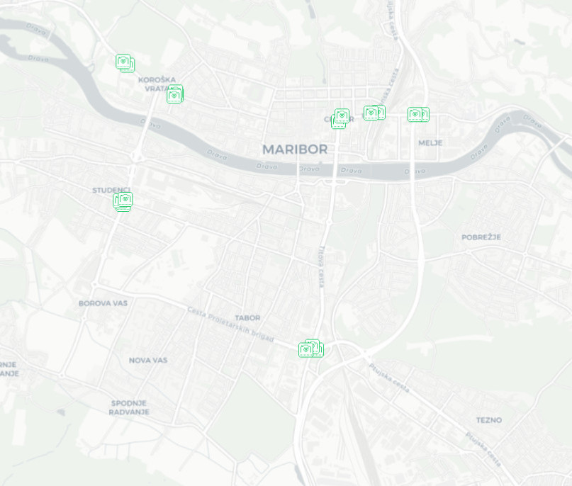
The layer keeps track on the locations of bicycle sheds, the layer was made for the needs of the Melinda 2020 project and represents the cross-sectional state.