 Slovenski INSPIRE metapodatkovni sistem
Keyword
WMS
7 record(s)
Type of resources
Categories
INSPIRE themes
Keywords
Contact for the resource
Formats
-
Product by the Pangeo project: http://www.pangeoproject.eu/ PanGeo provides information about the stability of the ground on which we live, work and play. Ground instability, or "geohazards", affect us all. They can be dangerous and costly, yet information on these phenomena can be difficult if not impossible to obtain. The PanGeo service provides entirely free access to geohazard information for many of the largest cities in Europe . The PanGeo service is aimed at local authorities, civil protection agencies, geological surveys, the public, insurers and businesses providing environmental and land reporting services. The service and products available are entirely free to use, even for commercial gain, providing appropriate credits are given (see licence terms). Information in PanGeo is derived from detailed analysis of local geological data combined with satellite measurements of ground movement.
-
Javni WMS spletni servisi prostorskega informacijskega sistema so namenjeni vpogledu v prosto dostopne podatke iz prostorskega informacijskega sistema. Storitev omogoča dostop do: - območja zaključenih prostorskih aktov, - namenska raba prostora, - enote urejanja prostora, - podenote urejanja prostora, - regulacijske črte, - regulacijske površine.
-
The public WMS online services of the spatial information system are intended for viewing freely accessible data from the spatial information system. The service provide access to: - administrative acts (points), - administrative acts (areas).
-
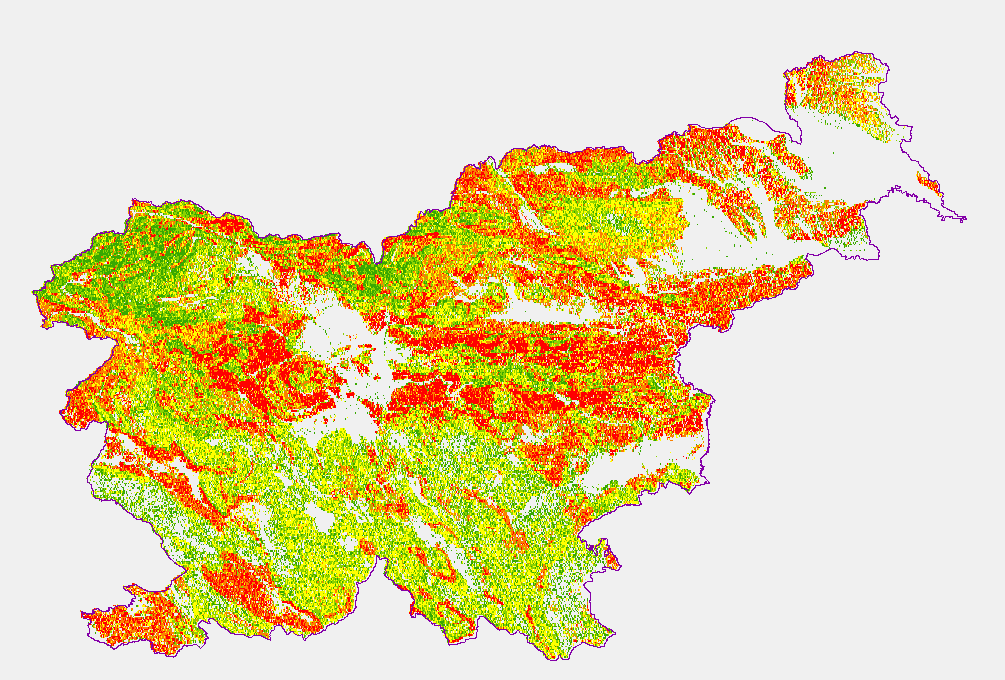
Karta podaja potencialna plazovita območja za območje celotne Slovenije v šestih razredih verjetnosti pojavljanja plazov; ni verjetnosti, zelo majhna verjetnost, majhna verjetnost, srednja verjetnost, velika verjetnost, zelo velika verjetnost. Zanesljivost napovedi je približno 0,88.
-
The underground geothermal conditions can be presented, irrespective of the aquifers' position, with the appropriate geothermal maps. These maps represent the expected isoterms at a depths and are derived from Geothermal maps - Expected temperatures , which are made with data from 302 boreholes. It is made on the basis of measured temperatures in accessible boreholes throughout the country. However, since the temperature field depends on the geological structure in the depths and tectonic characteristics, the course of the isotherms is a result of many influences, such as thermal conductivity of rocks, permeability and fracturing of rocks, all of which are reflected in the measured temperatures in boreholes. The distribution of boreholes, which were useful for the measurement of temperature, is very uneven and different as regard the depths.
-
Map represents the calculated (surface) heat-flow density (HFD) in mW/m2 with topographic correction. It is made with data from 119 boreholes from the measured temperatures in the available boreholes and measured thermal conductivity on cored rock samples from the same boreholes. The pattern of the HFD isolines is affected by numerous parameters, particularly the thermal conductivity of rocks, rock permeability and fracturing, fluid content of the rocks, and all are reflected in the measured temperature gradient in the boreholes.
-
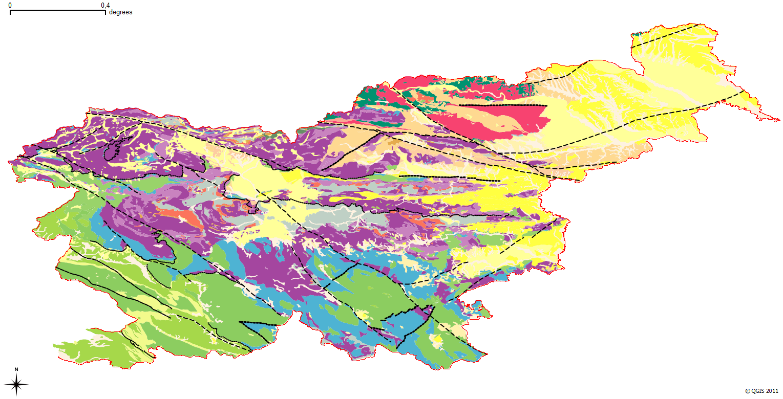
The harmonized geological map of Slovenia is a simplified version of the 1:250 000 scale Geological Map of Slovenia (Buser, 2009), which was compiled using the Basic Geological Map of Slovenia at a scale of 1: 100.000 (compiled by various authors during the 1960's to 1980's) with the addition of new information by Buser. It is primarily a lithostratigraphic map.The faults were selected for portrayal using two criteria; regional extent and tectonic importance. The map presented here was edited specifically for the purpose of the OneGeology-Europe project by M. Bavec, M. Novak, M. Poljak, M. Trajanova and D. Skaberne.