 TEST - Slovenski INSPIRE metapodatkovni sistem
Format
WFS
35 record(s)
Type of resources
Categories
INSPIRE themes
Keywords
Contact for the resource
Formats
Representation types
Scale
-
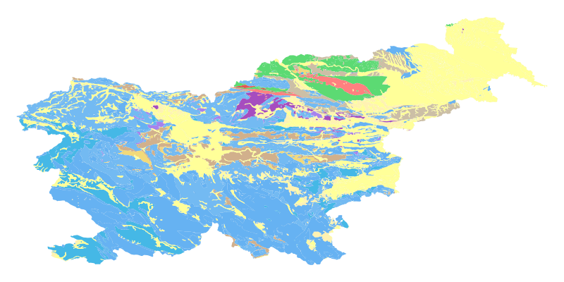
The harmonized geological map of Slovenia at a scale of 1:1,000,000 is a simplified version of the 1:250,000 scale Geological Map of Slovenia (Buser, 2009). The latter was compiled from the Basic Geological Map of Slovenia at a scale of 1: 100,000 (contributed by various authors between 1960's and 1980's and updated with new information gathered by S. Buser). The map is basically lithostratigraphic. The two layers incorporated in the map are lithostratigraphic units and major faults. The faults depicted on the map were selected using two criteria; regional extent and tectonic importance. The map presented here was edited specifically for the purpose of the OneGeology-Europe project by M. Bavec, M. Novak, M. Poljak, M. Trajanova and D. Skaberne.
-
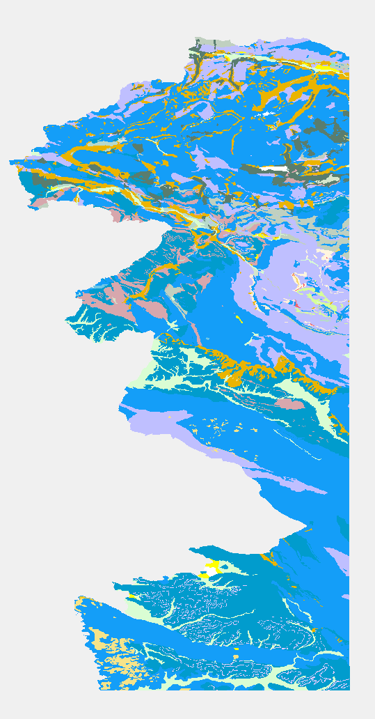
The Basic Geological Map of Slovenia as a part of joint Basic Geological Map of SFR Yugoslavia presents lithological and stratigraphic characteristics of rocks, their relationships, age and other. It is a key to the understanding of the geology of Slovenia. It consists of 23 sheets at a scale of 1: 100,000.
-
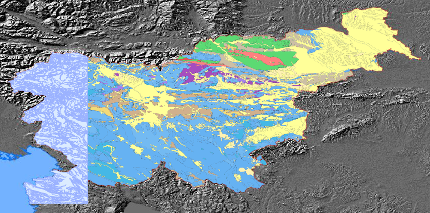
The pilot aplication service for calculating landslide susceptibility map and map of flood prone area.The harmonized geological map of Slovenia is a simplified version of the 1:250,000 scale Geological Map of Slovenia (Buser, 2009), which was compiled using the Basic Geological Map of Slovenia at a scale of 1: 100,000 (compiled by various authors between 1960's and 1980's) with the addition of new information by S. Buser. The map depicts the lithostratigraphic composition of Slovenia.The Basic Geological Map of Slovenia as a part of joint Basic Geological Map of SFR Yugoslavia presents lithological and stratigraphic characteristics of rocks, their relationships, age and other. It is a key to the understanding of the geology of Slovenia. It consists of 23 sheets at a scale of 1: 100,000.
-
WFS storitev za INSPIRE vodovodno omrežje / WaterPipe
-
Mineral deposits and resources INSPIRE compliant WFS services for Minerals4EU
-
WFS storitev za INSPIRE kanalizacijsko omrežje / SewerPipe
-
Javna spletna storitev Web Feature Service (WFS) omogoča dostop do podatkov zbirke Evidenca državne meje, ki vsebuje podatke o državni meji Republike Slovenije.
-
WFS service for ELF addresses. National dataset, LOD0. Recommended scalerange < 1:5.000. Included Feature types Address, AddressAreaName, AdminUnitName, PostalDescriptor, ThoroughfareName
-
WFS storitev za INSPIRE železnice / RailwayLink
-
WFS storitev za INSPIRE cestne odseke / RoadLink