 TEST - Slovenski INSPIRE metapodatkovni sistem
denominator
1000000
9 record(s)
Type of resources
Categories
INSPIRE themes
Keywords
Contact for the resource
Formats
Representation types
Scale
-
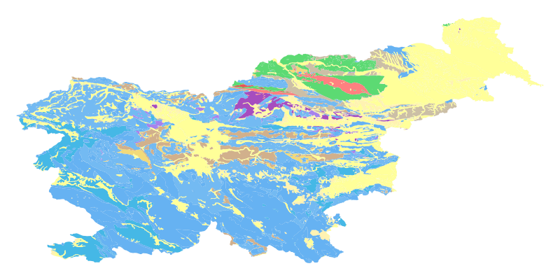
The harmonized geological map of Slovenia at a scale of 1:1,000,000 is a simplified version of the 1:250,000 scale Geological Map of Slovenia (Buser, 2009). The latter was compiled from the Basic Geological Map of Slovenia at a scale of 1: 100,000 (contributed by various authors between 1960's and 1980's and updated with new information gathered by S. Buser). The map is basically lithostratigraphic. The two layers incorporated in the map are lithostratigraphic units and major faults. The faults depicted on the map were selected using two criteria; regional extent and tectonic importance. The map presented here was edited specifically for the purpose of the OneGeology-Europe project by M. Bavec, M. Novak, M. Poljak, M. Trajanova and D. Skaberne.
-

The EuroGlobalMap for Slovenia is a part of the European collection of topographic data at 1: 1 000 000 scale.
-

Register of Geographical Names is a basic national spatial layer. It includes geographical names of spatial features, which have some historical, ethnically or social important identity (these features are more or less permanent). The register includes names of populated places, names of hydrography features, names of relief features and names of areas. The sources are topographical maps at a scale of 1 : 5.000 and 1 : 10.000, 1 : 25.000, 1 : 250.000 and 1 : 1.000.000. Register of Geographical Names is a basic spatial layer used for georeferencing of different spatial features, for linking of other spatial layers with geographical names, for different topographical and cartographical applications, for statistical and linguistic analysis.
-

The vector data collection DPK 1000V is an object-oriented cartographic database at 1 : 1 000 000 scale. Elements on the map are divided into eight objects groups: mathematical elements, settlements and objects, communications, relief, hydrography, land cover, boundaries and dividing line, geographical names. The data set is used for "rough" orientation in the space and for the needs of large scale and thematic displaying.
-
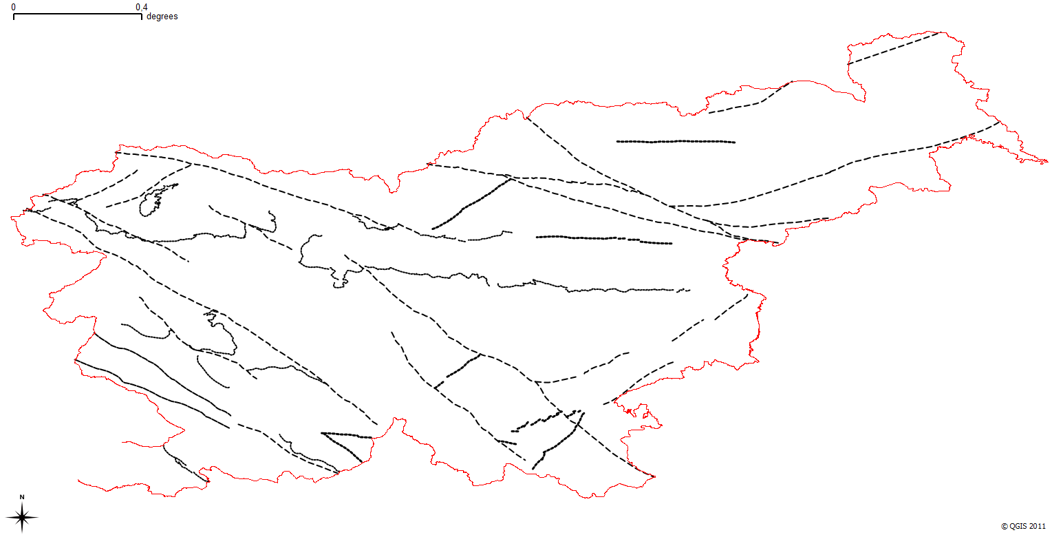
The harmonized geological map of Slovenia is a simplified version of the 1:250 000 scale Geological Map of Slovenia (Buser, 2009), which was compiled using the Basic Geological Map of Slovenia at a scale of 1: 100.000 (compiled by various authors during the 1960's to 1980's) with the addition of new information by Buser. It is primarily a lithostratigraphic map.The faults were selected for portrayal using two criteria; regional extent and tectonic importance. The map presented here was edited specifically for the purpose of the OneGeology-Europe project by M. Bavec, M. Novak, M. Poljak, M. Trajanova and D. Skaberne.
-

The National General Map at 1 : 1 000 000 Scale shows the entire territory of Slovenia on one sheet of A4 format. Layers: mathematical elements, settlements and objects, communications, relief, hydrography, land cover, boundaries and dividing line, geographical names. The dataset is used for "rough" geo-orientation and for the needs of large scale and thematic displaying.
-
The Basic Geological Map of Slovenia as a part of joint Basic Geological Map of SFR Yugoslavia presents lithological and stratigraphic characteristics of rocks, their relationships, age and other. It is a key to the understanding of the geology of Slovenia. It consists of 23 sheets at a scale of 1: 100,000.
-

National Maps are cartographically processed topographic data, which are managed in the national spatial coordinate reference system and are presented in the national cartographic projection. National Maps are managed in digital format. National maps for the territory of the Republic of Slovenia are: - National Topographic Map at a scale 1 : 50 000, - National General Maps at a scales 1 : 250 000, 1 : 500 000, 1 : 750 000 and 1 : 1 000 000, - maps produced on the basis of an agreement or contract with the public authorities of other countries or international civil institutions and organizations and are showing the territory of the Republic of Slovenia.
-
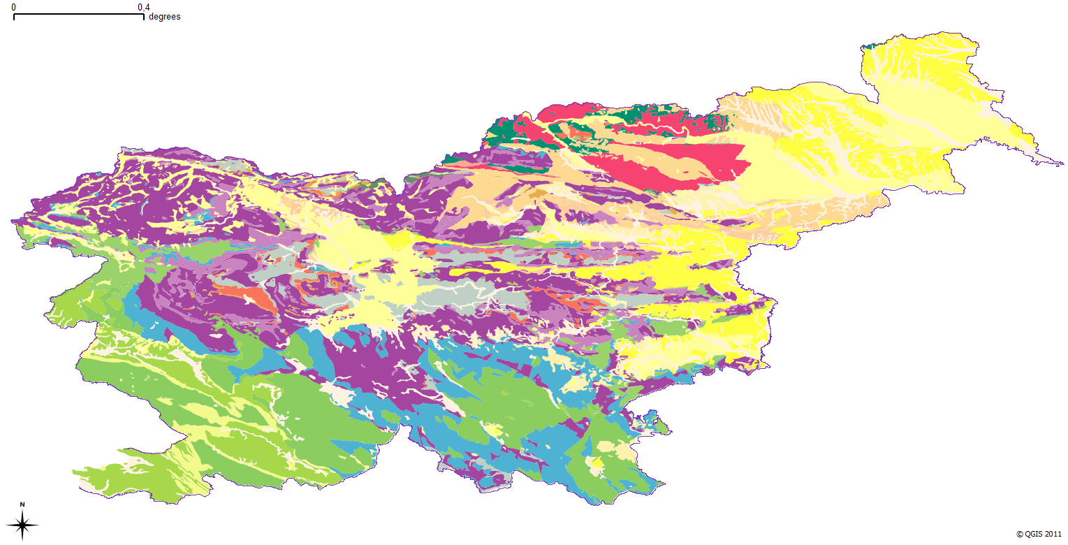
The harmonized geological map of Slovenia is a simplified version of the 1:250 000 scale Geological Map of Slovenia (Buser, 2009), which was compiled using the Basic Geological Map of Slovenia at a scale of 1: 100.000 (compiled by various authors during the 1960's to 1980's) with the addition of new information by Buser. It is primarily a lithostratigraphic map.The faults were selected for portrayal using two criteria; regional extent and tectonic importance. The map presented here was edited specifically for the purpose of the OneGeology-Europe project by M. Bavec, M. Novak, M. Poljak, M. Trajanova and D. Skaberne.