 TEST - Slovenski INSPIRE metapodatkovni sistem
Keyword
regionalna geologija
8 record(s)
Type of resources
Categories
INSPIRE themes
Keywords
Formats
Representation types
Scale
-

Layer Geomorphologic Features shows the location of various types of geomorphological phenomena. Only point data are included.
-

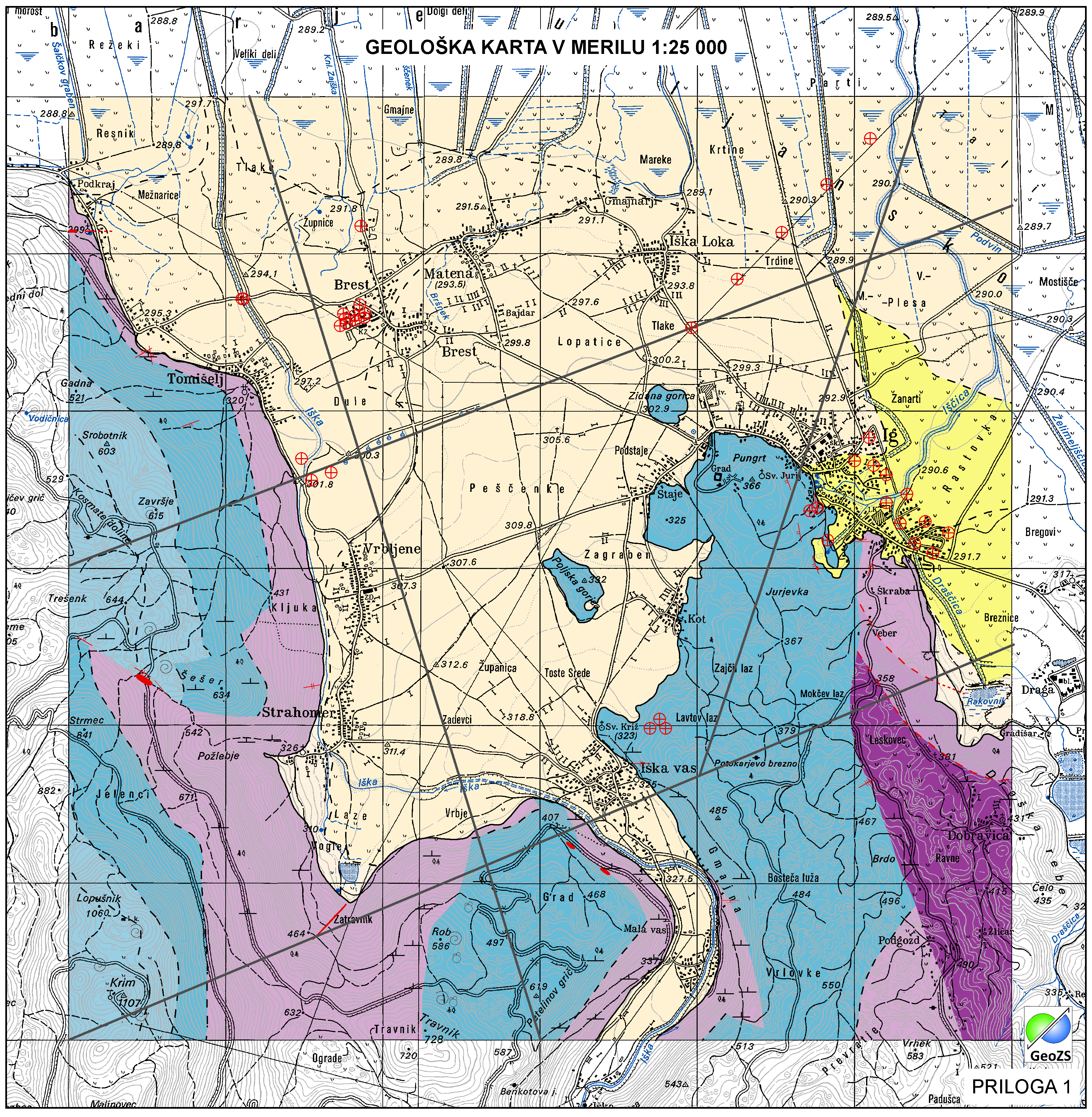
Geological Units are polygons, defined by equal composition (lithology) and age.
-

Layer Boreholes shows the localities where structural boreholes were drilled.
-

Geophysical cross sections show the geophysical characteristics of the sediments and bedrock at depth.
-

Layer shows the zones where the rock is systematically fractured.
-
Layer shows discontinuities in the geological structure, and characterizes them according to their type and observation method.
-
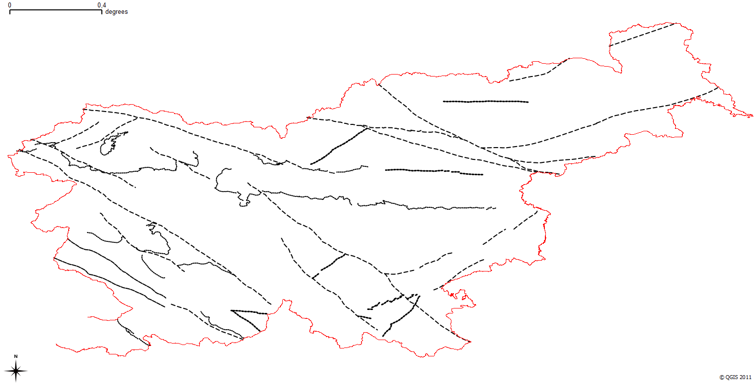
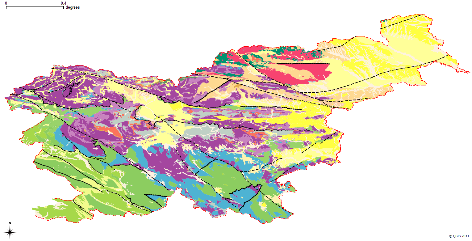
The harmonized geological map of Slovenia is a simplified version of the 1:250 000 scale Geological Map of Slovenia (Buser, 2009), which was compiled using the Basic Geological Map of Slovenia at a scale of 1: 100.000 (compiled by various authors during the 1960's to 1980's) with the addition of new information by Buser. It is primarily a lithostratigraphic map.The faults were selected for portrayal using two criteria; regional extent and tectonic importance. The map presented here was edited specifically for the purpose of the OneGeology-Europe project by M. Bavec, M. Novak, M. Poljak, M. Trajanova and D. Skaberne.
-
The harmonized geological map of Slovenia is a simplified version of the 1:250 000 scale Geological Map of Slovenia (Buser, 2009), which was compiled using the Basic Geological Map of Slovenia at a scale of 1: 100.000 (compiled by various authors during the 1960's to 1980's) with the addition of new information by Buser. It is primarily a lithostratigraphic map.The faults were selected for portrayal using two criteria; regional extent and tectonic importance. The map presented here was edited specifically for the purpose of the OneGeology-Europe project by M. Bavec, M. Novak, M. Poljak, M. Trajanova and D. Skaberne.