 Slovenski INSPIRE metapodatkovni sistem
Keyword
Prostorski informacijski sistem
9 record(s)
Type of resources
Categories
INSPIRE themes
Keywords
Contact for the resource
Formats
Representation types
Scale
-
Geographical areas of spatial plans from completed procedures include: - areas of national spatial plans, - areas of regional spatial plans, - areas of local spatial plans. Geographical areas of spatial plans are part of database of spatial plans.
-
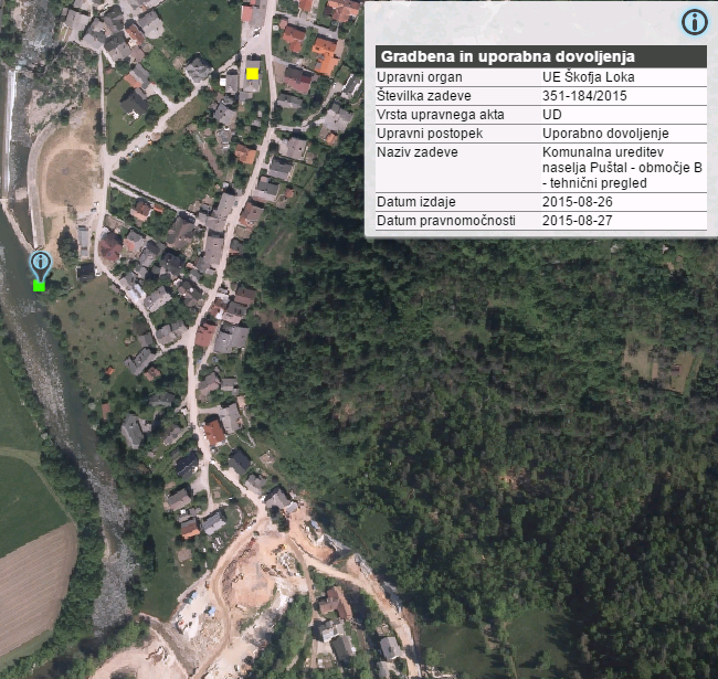
Construction database contains legal acts related with the construction: - building permits - operating permit - legal acts issued in the inspection procedure
-
Javni WFS spletni servisi Prostorskega informacijskega sistema so namenjeni dostopu do prosto dostopnih podatkov iz Prostorskega informacijskega sistema. Storitev omogoča dostop do: - območja zaključenih prostorskih aktov, - namenska raba prostora, - enote urejanja prostora, - podenote urejanja prostora, - regulacijske črte, - regulacijske površine.
-
Javni WMS spletni servisi prostorskega informacijskega sistema so namenjeni vpogledu v prosto dostopne podatke iz prostorskega informacijskega sistema. Storitev omogoča dostop do: - območja zaključenih prostorskih aktov, - namenska raba prostora, - enote urejanja prostora, - podenote urejanja prostora, - regulacijske črte, - regulacijske površine.
-
Javni WFS spletni servisi prostorskega informacijskega sistema so namenjeni prenosu prosto dostopnih podatkov iz prostorskega informacijskega sistema. Storitev omogoča dostop do: - upravni akti (točke), - upravni akti (območja).
-
The public WMS online services of the spatial information system are intended for viewing freely accessible data from the spatial information system. The service provide access to: - administrative acts (points), - administrative acts (areas).
-
This download service provides INSPIRE compliant data.
-
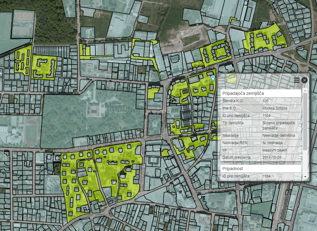
For the needs of spatial planning and for implementing the policy of Land Registry, the Spatial Management Act (hereinafter: ZUreP-3) introduces a new record, called the Register of building land. It contains information on built-up land and non-built-up building land. - Built-up land is divided into associated building land, the associated land of construction engineering facilities and construction lots. The difference between the associated building land and the associated land of construction engineering facilities is that the associated building land will be determined in a process of mass capture, while the building lots are determined in the administrative procedure. The associated building land is therefore the first approximation of the building lot. - Non-built-up building land is classified into development stages which are determined by ZUreP-2 according to their equipment with public infrastructure, the status of the legal regime on land and the regulation of land with spatial planning documents. The Register of building land is in accordance with the ZUreP-3 intended for the planning of usage land or new building land in the process of preparation of municipal spatial planning documents, planning of utility equipment, implementation of Land Registry policy, rehabilitation and ensuring adequate parcel and ownership structure, ensuring affordable land for residence and work, management of land in the public interest and for the assessment of duties on building land and evaluation of building land. Register of building land is also the basis for providing information on developmental stages and other properties of building land for interested investors. The Register of building land will enable the implementation of Land Registry policy, increase the awareness of investors, and thus significantly contribute to a more successful development.
-
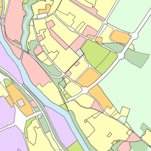
Namenska raba prostora je s prostorskimi akti določena raba površin in objektov, ki ob upoštevanju pretežnosti in prepletanja dopustnih dejavnosti določa namen, za katerega se lahko te uporabljajo. Namenska raba prostora se vodi v okviru zbirke prostorskih aktov.