 TEST - Slovenski INSPIRE metapodatkovni sistem
denominator
250000
9 record(s)
Type of resources
Categories
INSPIRE themes
Keywords
Contact for the resource
Formats
Representation types
Scale
Resolution
-

The National General Map at 1: 250 000 Scale shows the entire territory of Slovenia on one sheet of A0 format. Layers: mathematical elements, settlements and objects, communications, relief, hydrography, land cover, boundaries and dividing line, geographical names. The map is also available in printed form. The data set is used for "rough" orientation in the space and for the needs of large scale and thematic displaying.
-

Register of Geographical Names is a basic national spatial layer. It includes geographical names of spatial features, which have some historical, ethnically or social important identity (these features are more or less permanent). The register includes names of populated places, names of hydrography features, names of relief features and names of areas. The sources are topographical maps at a scale of 1 : 5.000 and 1 : 10.000, 1 : 25.000, 1 : 250.000 and 1 : 1.000.000. Register of Geographical Names is a basic spatial layer used for georeferencing of different spatial features, for linking of other spatial layers with geographical names, for different topographical and cartographical applications, for statistical and linguistic analysis.
-
-

The vector collection of data DPK 250V is object oriented cartographic database at 1 : 250 000 scale. Elements on the map are divided into eight groups: mathematical elements, settlements and objects, communications, relief, hydrography, land cover, boundaries and dividing lines, geographical names.
-

The EuroRegionalMap for Slovenia is part of the European collection of topographic data at 1: 250 000 scale.
-
-
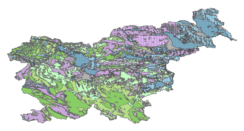
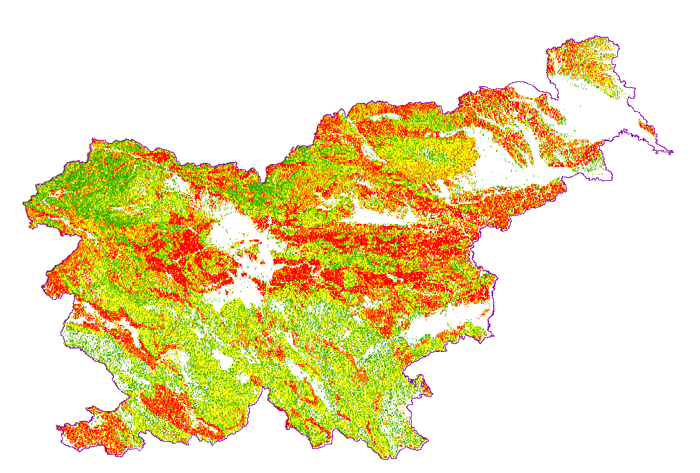
Hydrogeological map of Slovenia 1:250.000 represent hydrogeological characteristics of overlaying strata. The identification and classification of strata is based on LAWA classification. Hydrogeological units of LAWA classification are defined on type of porosity and basic petrographical composition. Geological strata with kartic porosity were additionaly classified after karstification stage.
-

National Maps are cartographically processed topographic data, which are managed in the national spatial coordinate reference system and are presented in the national cartographic projection. National Maps are managed in digital format. National maps for the territory of the Republic of Slovenia are: - National Topographic Map at a scale 1 : 50 000, - National General Maps at a scales 1 : 250 000, 1 : 500 000, 1 : 750 000 and 1 : 1 000 000, - maps produced on the basis of an agreement or contract with the public authorities of other countries or international civil institutions and organizations and are showing the territory of the Republic of Slovenia.
-
Prikaz hidrogeoloških enot po IAH klasifikaciji, kjer je težišče v prvi vrsti na tipu poroznosti in obsežnosti in v drugi vrsti na izdatnosti vodonosnikov.Karta je bila izdelana z namenom pridobiti podlago za izdelavo Karte vodonosnikov v merilu 1:250.000 ter kot pomoč pri strategiji izrabe podzemne vode ter zaščite in upravljanja z viri pitne in tehnološke vode. Karta je bila izdelana z namenom pridobiti podlago za izdelavo Karte vodonosnikov v merilu 1:250.000 ter kot pomoč pri strategiji izrabe podzemne vode ter zaščite in upravljanja z viri pitne in tehnološke vode.