 Slovenski INSPIRE metapodatkovni sistem
Keyword
Hydrography
14 record(s)
Type of resources
Categories
INSPIRE themes
Keywords
Contact for the resource
Formats
Scale
-
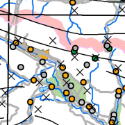
Vector data collection DPK 750V is an object-oriented cartographic database at 1 : 750 000 scale. Elements on the map are divided into eight object groups: mathematical elements, settlements and objects, communications, relief, hydrography, land cover, boundaries and dividing line, geographical names. The data set is used for "rough" geo-orientation and for the needs of large scale and thematic displaying.
-
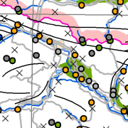
The vector data collection DPK 1000V is an object-oriented cartographic database at 1 : 1 000 000 scale. Elements on the map are divided into eight objects groups: mathematical elements, settlements and objects, communications, relief, hydrography, land cover, boundaries and dividing line, geographical names. The data set is used for "rough" orientation in the space and for the needs of large scale and thematic displaying.
-
The National General Map at 1 : 1 000 000 Scale shows the entire territory of Slovenia on one sheet of A4 format. Layers: mathematical elements, settlements and objects, communications, relief, hydrography, land cover, boundaries and dividing line, geographical names. The dataset is used for "rough" geo-orientation and for the needs of large scale and thematic displaying.
-
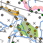
Vector data collection DPK 500V is an object-oriented cartographic database at 1: 500 000 scale. Elements on the map are divided into eight object groups: mathematical elements, settlements and objects, communications, relief, hydrography, land cover, boundaries and dividing line, geographical names. The data set is used for "rough" geo-orientation and for the needs of large scale and thematic displaying.
-
The National General Map at 1: 250 000 Scale shows the entire territory of Slovenia on one sheet of A0 format. Layers: mathematical elements, settlements and objects, communications, relief, hydrography, land cover, boundaries and dividing line, geographical names. The map is also available in printed form. The data set is used for "rough" orientation in the space and for the needs of large scale and thematic displaying.
-
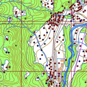
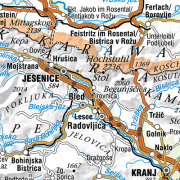
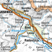
A brief description: National Topographic Map at 1 : 50 000 scale - vector data (DTK 50V) is an object-oriented cartographic database (vector elements). The objects are categorized into eight object groups: - mathematical elements - settlements and facilities - communications - relief - hydrography - land cover - boundaries and dividing lines - geographical names. DTK 50V is from 2017 available also as a seamless vector cartographic set of data, which is maintained as SHP files (46). SHP files are also available for the users. The data of the vector DTK 50 are used for spatial planning, for field orientation purposes, as a basis for other topics and as a source for the production of different maps.
-
The vector collection of data DPK 250V is object oriented cartographic database at 1 : 250 000 scale. Elements on the map are divided into eight groups: mathematical elements, settlements and objects, communications, relief, hydrography, land cover, boundaries and dividing lines, geographical names.
-
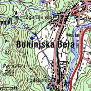
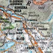
The territory of Republic of Slovenia covers 58 sheets of the National Topographic Map at 1 : 50 000 scale. Raster images with DTK 50 sheets are provided. Besides the joined color layer also eight geolocated raster layers are provided: - settlements, communications, names - border of roads and rocks - roads in relation to road surface, traffic surfaces - relief - contour lines - water - vegetation - UTM network - relief shadows. From year 2017 the map is available also as seamless cartographic raster layer. Georeferenced raster image is written in TIFF + TFW files in resolution 4 m (317.5 dpi) and cut into 99 rectangle tiles in 9 rows and 11 columns. DTK 50 is intended for spatial planning, for orientation on the field, as base for other themes, as a source for making other maps. Raster and vector data are available as free data.
-
The National General Map at 1 : 500 000 Scale shows the entire territory of Slovenia on one sheet of A2 format. Layers: mathematical elements, settlements and objects, communications, relief, hydrography, land cover, boundaries and dividing line, geographical names. The map is used for "rough" orientation in the space and for the needs of large scale and thematic displaying.
-
This download service provides INSPIRE compliant data.