 Slovenski INSPIRE metapodatkovni sistem
Contact for the resource
Geološki zavod Slovenije
46 record(s)
Type of resources
Categories
INSPIRE themes
Keywords
Contact for the resource
Formats
Representation types
Scale
Resolution
-
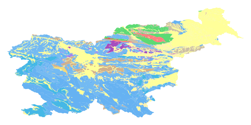
The harmonized geological map of Slovenia at a scale of 1:1,000,000 is a simplified version of the 1:250,000 scale Geological Map of Slovenia (Buser, 2009). The latter was compiled from the Basic Geological Map of Slovenia at a scale of 1: 100,000 (contributed by various authors between 1960's and 1980's and updated with new information gathered by S. Buser). The map is basically lithostratigraphic. The two layers incorporated in the map are lithostratigraphic units and major faults. The faults depicted on the map were selected using two criteria; regional extent and tectonic importance. The map presented here was edited specifically for the purpose of the OneGeology-Europe project by M. Bavec, M. Novak, M. Poljak, M. Trajanova and D. Skaberne.
-
The Basic Geological Map of Slovenia as a part of joint Basic Geological Map of SFR Yugoslavia presents lithological and stratigraphic characteristics of rocks, their relationships, age and other. It is a key to the understanding of the geology of Slovenia. It consists of 23 sheets at a scale of 1: 100,000.
-
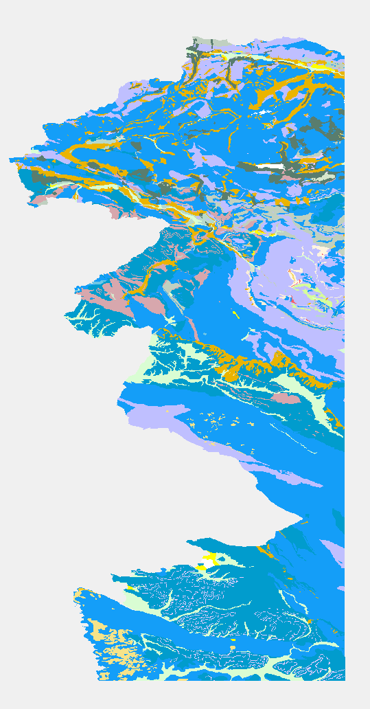
Hydrogeological map of Slovenia 1:250.000 represent hydrogeological characteristics of overlaying strata. The identification and classification of strata is based on LAWA classification. Hydrogeological units of LAWA classification are defined on type of porosity and basic petrographical composition. Geological strata with kartic porosity were additionaly classified after karstification stage.
-
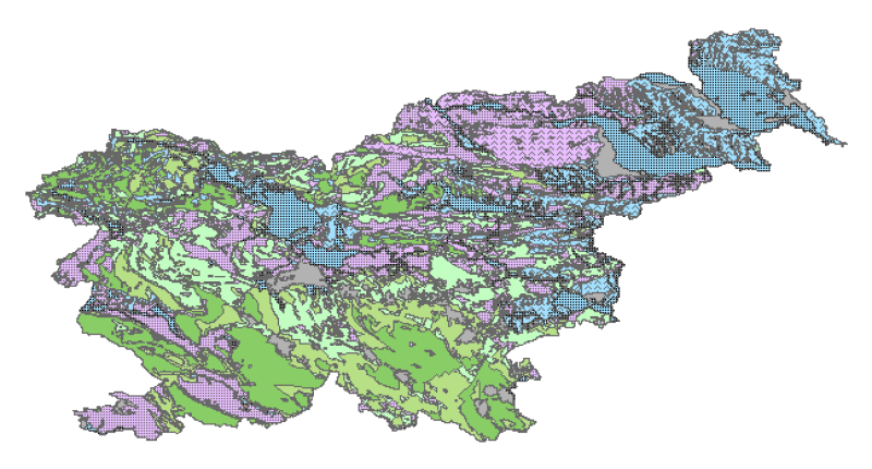
Mineral deposits and resources
-

Geophysical cross sections show the geophysical characteristics of the sediments and bedrock at depth.
-
The harmonized geological map of Slovenia is a simplified version of the 1:250 000 scale Geological Map of Slovenia (Buser, 2009), which was compiled using the Basic Geological Map of Slovenia at a scale of 1: 100.000 (compiled by various authors during the 1960's to 1980's) with the addition of new information by Buser. It is primarily a lithostratigraphic map.The faults were selected for portrayal using two criteria; regional extent and tectonic importance. The map presented here was edited specifically for the purpose of the OneGeology-Europe project by M. Bavec, M. Novak, M. Poljak, M. Trajanova and D. Skaberne.
-
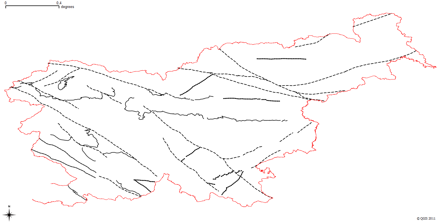
Layer shows discontinuities in the geological structure, and characterizes them according to their type and observation method.
-
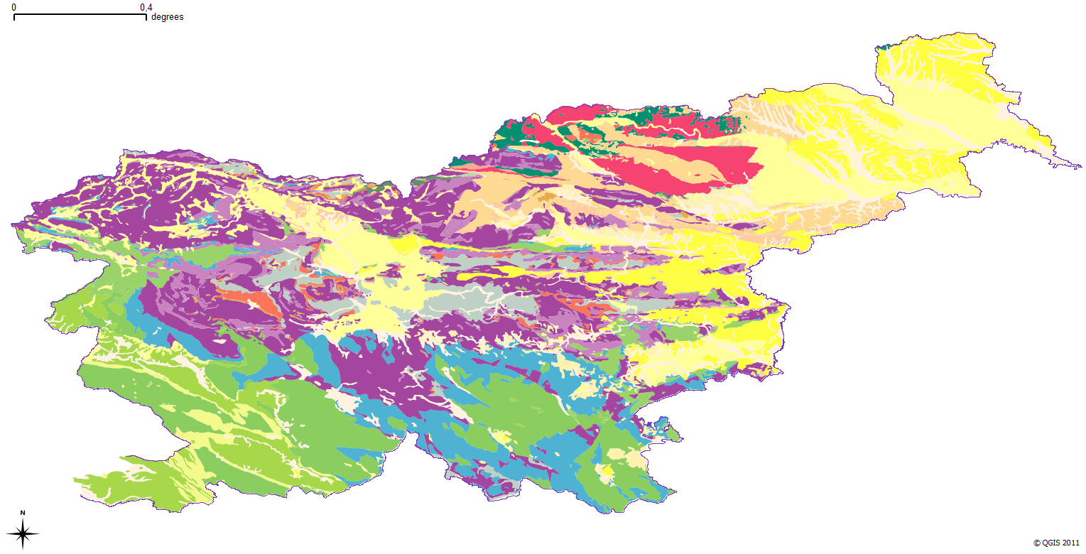
The harmonized geological map of Slovenia is a simplified version of the 1:250 000 scale Geological Map of Slovenia (Buser, 2009), which was compiled using the Basic Geological Map of Slovenia at a scale of 1: 100.000 (compiled by various authors during the 1960's to 1980's) with the addition of new information by Buser. It is primarily a lithostratigraphic map.The faults were selected for portrayal using two criteria; regional extent and tectonic importance. The map presented here was edited specifically for the purpose of the OneGeology-Europe project by M. Bavec, M. Novak, M. Poljak, M. Trajanova and D. Skaberne.
-

Layer shows the zones where the rock is systematically fractured.
-
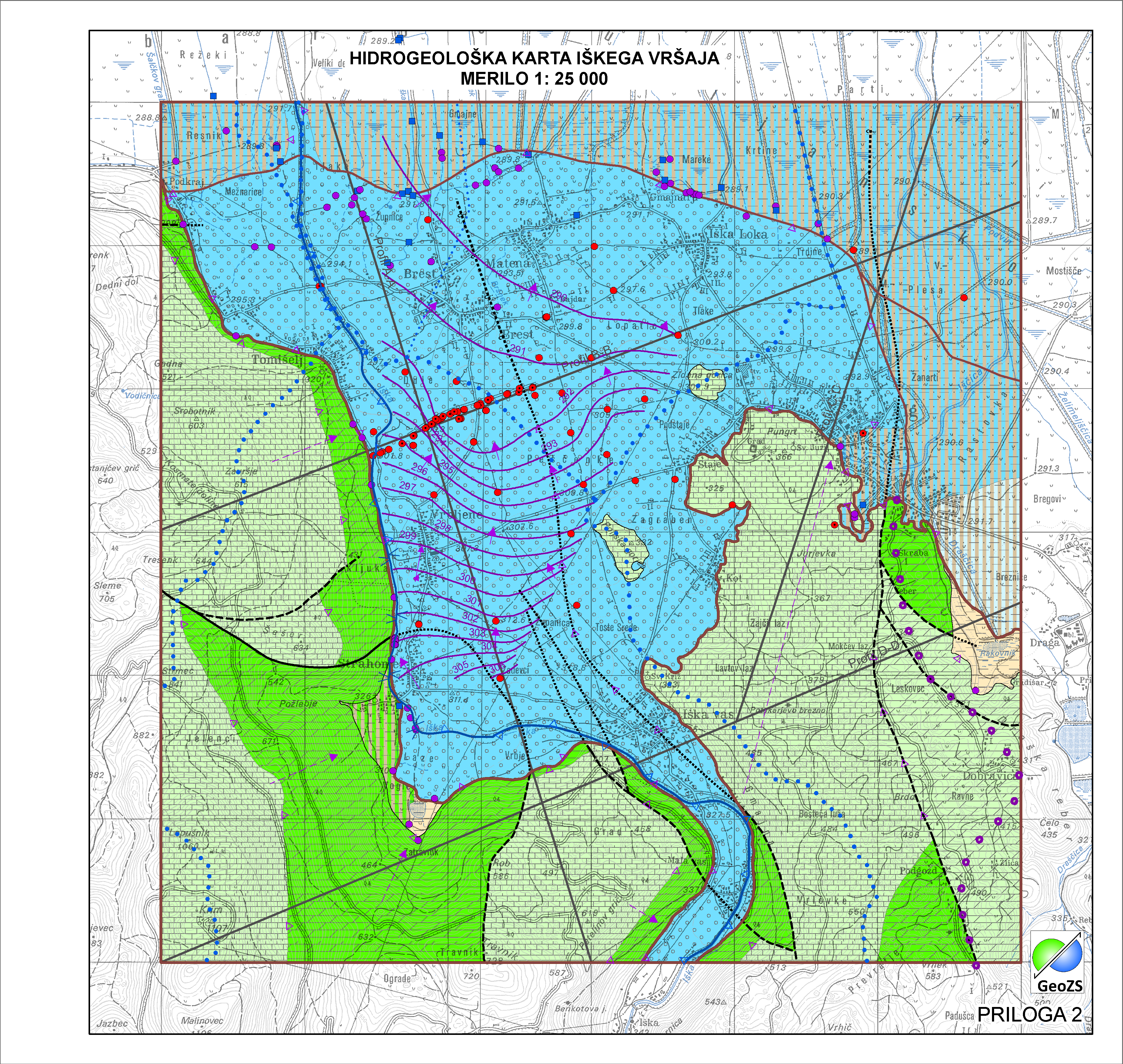
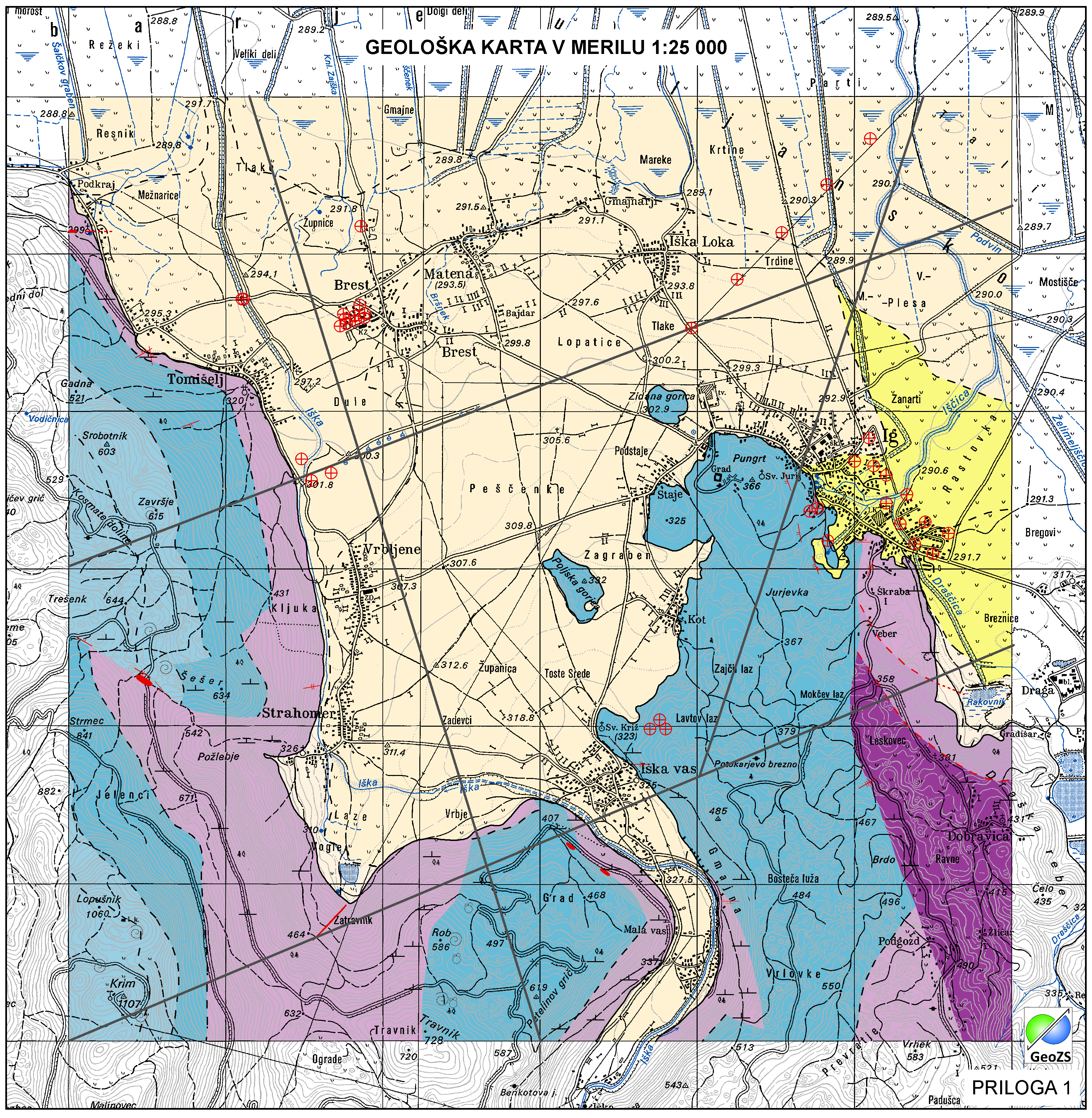
Relief karbonatne podlage pod aluvijalnim prodnim zasipom Iškega vršaja z obrobjem je narejena na popravljenem modelu po Menceju (1990), ki je bila narejena v okviru Projekta INCOME (Janža e tal., 2012). Za potrebe hidrogeološke karta Iškega vršaja je bila podlaga popravljena s dodatnimi seizmičnimi podatki in podatki iz vrtin projekta INCOME. Podlaga je pripravljena v grid obliki 5x5.