 Slovenski INSPIRE metapodatkovni sistem
Keyword
Podatki velike vrednosti
33 record(s)
Type of resources
Categories
INSPIRE themes
Keywords
Formats
Representation types
Scale
Resolution
-

Digital Elevation Model is a description of the relief in the form of a model, where the height of the relief is given for each node of the square grid. The model represents a Digital Relief Model of Slovenia and Digital Elevation Model with grid size 5 x 5 m (DMV 5). Digital Relief Model of Slovenia was established using various geodetic data, using the method of weighted aggregation from resources with some geomorphological corrections. It was made in 2001-2005 and is available as a model in a square grid with a cell size 12.5 m, 25 m and 100 m (DMV 12.5, DMV 25 and DMV 100). DMV 5 was created in 2006 and was regularly maintained until 2014 using cyclic aerial survey of Slovenia (CAS). Some additional data sources were used to produce the model as well. The data of both models are available as ASCII files (y, x, H), for example: 401000.0 112000.0 251.71 401025.0 112000.0 241.03 401050.0 112000.0 230.51 401075.0 112000.0 219.88 401100.0 112000.0 208.31 401125.0 112000.0 195.45
-
Vplivna območja posameznih kopalnih voda so območja, kjer lahko izvajanje človekovih dejavnosti vpliva na kakovost kopalne vode in lahko predstavlja vir tveganja za zdravje kopalcev. Podatkovni niz prikazuje vplivna območja kopalnih voda po Uredbi o upravljanju kakovosti kopalnih voda (Uradni list RS, št. 25/08). Vplivna območja so določena na podlagi kriterijev iz Uredba o odvajanju in čiščenju komunalne odpadne vode (Uradni list RS, št. 98/15 in spr.) in predhodne Uredbe o emisiji snovi pri odvajanju odpadne vode iz komunalnih čistilnih naprav (Uradni list RS, št. 45/07 in spr.) in Uredbe o emisiji snovi pri odvajanju odpadne vode iz malih komunalnih čistilnih naprav (Uradni list RS, št. 98/07 in spr.). Za vplivna območja kopalnih voda so skladno z navedenima predpisoma določene posebne zahteve glede odvajanja in čiščenja komunalnih odpadnih voda. Podatki so namenjeni državi in lokalnim skupnostim kot podlaga za izvajanje ukrepov na področju upravljanja kopalnih voda ali izvajanje drugih nalog upravljanja voda, za izvajanje ukrepov na področju varstva okolja, ki se nanašajo na odvajanje in čiščenje komunalnih odpadnih voda ali na izdajo okoljevarstvenih dovoljenj. Podatki so namenjeni tudi javnosti, kot informacija, kje se nahajajo vplivna območja kopalnih voda.
-
Prispevno območje kopalne vode je območje, s katerega vse celinske vode odtekajo preko potokov, rek ali jezer v kopalno vodo in se določi na podlagi hidrografskih razvodnic. Podatkovni niz prikazuje prispevna območja kopalnih voda po Uredbi o upravljanju kakovosti kopalnih voda (Uradni list RS, št. 25/08).
-
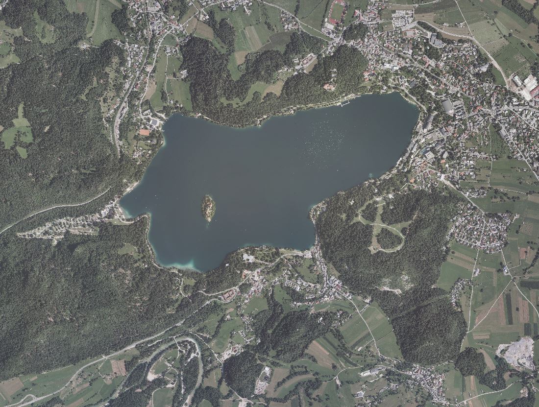
An orthophoto is an aerial photograph that has been transformed from a central to an orthogonal projection by taking into account terrain relief data and the absolute orientation of the aerial photographs. In this process, the effects of the camera optics, camera tilt, and terrain undulation are removed. Orthophotos are metrically comparable to line maps, and their sheet division corresponds to that of TTN5. All orthophotos are available in TIFF format. Different orthophotos are produced according to spatial resolution and colour spectrum: DOF025 – colour (RGB) orthophoto with a ground sampling distance (GSD) of 0.25 m DOF050 – colour (RGB) orthophoto with a ground sampling distance (GSD) of 0.50 m DOF050IR – colour near-infrared orthophoto (IR, R and G) with a ground sampling distance (GSD) of 0.50 m
-
Prispevno območje vodnih teles vodotokov je območje, s katerega vse površinske vode odtekajo v posamezno vodno telo površinskih voda (vodotok, jezero ali morje).
-
Prikazana merilna mesta predstavljajo osnovno mrežo merilnih mest državnega hidrološkega monitoringa podzemnih voda na vodnih telesih podzemnih voda s prevladujočimi medzrnskimi vodonosniki za tekoče leto.
-
Podatke Opozorilne karte se uporablja za namen opredelitve potrebnosti izdelave natančnejših analiz za podajo mnenja o poplavni ogroženosti na določenem območju. Pravilnik o metodologiji za določanje območij, ogroženih zaradi poplav in z njimi povezane erozije celinskih voda in morja, ter o načinu razvrščanja zemljišč v razrede ogroženosti (Uradni list RS, št. 60/07) v 5. členu opredeljuje oceno poplavne nevarnosti kot podlago za določitev poplavnih območij in njihovo razvrščanje. Rezultati ocene se prikažejo na opozorilni karti poplav, ki vsebuje podatke o topografiji in rabi tal, znotraj povodij in porečij pa se označijo tudi (8. člen): - mejna črta možnega dosega poplav oziroma del tekočih in stoječih voda ali del obale morja, kjer je znano, da prihaja do poplav, vključno z oznako smeri poplavljanja, - mejna črta možnega obsega erozijskih pojavov oziroma del tekočih in stoječih voda ali dela obale morja, kjer je znano, da prihaja do erozije, - mesta posameznih poplavnih dogodkov s točkovnimi oznakami, - s točkovnimi ali linijskimi oznakami posamezni vodni objekti, kjer lahko nastanejo poplave in erozija zaradi napačnega obratovanja ali porušitve. Opozorilna karta poplav in erozije vsebuje tudi besedilni del, ki obsega opis poplavnih in erozijskih dogodkov, predvsem tistih, ki bi se lahko v prihodnosti ponovili in v zvezi z njimi predvsem datum, vir podatkov, opis dogodka in posledic na življenje in zdravje ljudi, okolje, gospodarske in negospodarske dejavnosti, kulturno dediščino ter druge pomembne informacije o razmerah na določenem območju. Opozorilna karta poplav in erozije lahko, kjer je to smiselno, vsebuje tudi ocene bodočih poplav in erozije ter njihovih posledic na življenje ljudi, okolje, razvoj gospodarskih in negospodarskih dejavnosti z upoštevanjem dolgoročnega načrtovanega razvoja in podnebnih sprememb. Podatkovni sloji vsebujejo prikazana območja poplavljanja, ki so bila zabeležena ob poplavnih dogodkih ali modelirana v sklopu izdelave hidrološko-hidravličnih študij ali navedena v drugih virih. Ploskovni prostorski objekti predstavljajo ovojnico dosegov poplav pri različnih dogodkih ali scenarijih dogodkov. Namen podatkovnih slojev je prostorski prikaz možnih lokacij, obsega in pogostosti pojavljanja poplav, ki lahko služi opozarjanju na poplavno nevarnost pri prostorskem načrtovanju ter osveščanju javnosti o poplavni problematiki. Opozorilna karta poplav v vodnem katastru vsebuje: - območja zelo redkih poplav, ki vključujejo poplave s povratno dobo 50 ali več let, - območja redkih poplav, ki vključujejo poplave s povratno dobo od 10 do 20 let, - območja pogostih poplav, ki vključujejo poplave s povratno dobo od 2 do 5 let. Prikazani poligoni so opremljeni z oceno zanesljivosti (1...najmanjša, 10...največja zanesljivost prikaza, ki zajema tako vsebinsko zanesljivost kot natančnost zajema podatka). Opozorilna karta poplav v vodnem katastru vsebuje tudi: - poplavne dogodke. Drugi podatki ocene poplavne nevarnosti v skladu s 7. členom Pravilnika o metodologiji za določanje območij, ogroženih zaradi poplav in z njimi povezane erozije celinskih voda in morja, ter o načinu razvrščanja zemljišč v razrede ogroženosti (Uradni list RS, št. 60/07) so: - funkcionalne razlivne površine (Podatkovni sloj funkcionalnih razlivnih površin prikazuje poplavne površine, namenjene nadzorovanemu razlivanju viškov voda, na podlagi karakteristične gladine v zadrževalniku ali koti vrha pregrade ter izrisa plastnic na osnovi DMV5 oziroma izrisa na osnovi DOF ali TTN 5000. Sloj je izdelan na podlagi podatkov iz razpoložljive dokumentacije IzVRS, DRSV in njenih koncesionarjev, študij, publikacij, člankov, ipd.), - odseki poplavljanja (Podatkovni sloj prikazuje odseke vodotokov, ki poplavljajo, a ni znan njihov doseg poplave. Sloj je izdelan na podlagi podatkov iz razpoložljive dokumentacije IzVRS, DRSV in njenih koncesionarjev, študij, publikacij, člankov, ipd), - smeri poplavljanja (Sloj prikazuje smeri poplavnega toka. Smer poplavnega toka je smer, kamor teče voda iz vodotoka oziroma kamor je tok vode na poplavnem območju usmerjen. Sloj je izdelan na podlagi podatkov iz razpoložljive dokumentacije IzVRS, DRSV in njenih koncesionarjev, študij, publikacij, člankov, ipd.), - razlivna območja (Podatkovni sloj razlivnih območij vsebuje strateško opredeljena in operativno zaščitena območja razlivanja visokih voda v Sloveniji. Izdelan je bil na podlagi podatkov državnih, regionalnih in lokalnih analiz in izvedbe zaščitnih ukrepov v okviru državnega in občinskega prostorskega načrtovanja.), - območja poplavljanja (Podatkovni sloj vsebuje območja zelo redkih poplav (poplav s povratno dobo 50 let ali več) fluvialnega in pluvialnega tipa, ki so bila določena s pomočjo poenostavljenega hidrološko-hidravličnega modela in na podlagi razpoložljivih podatkov o reliefu, pokrovnosti tal, padavinah in pretokih. Uporaba podatkovnega sloja je primerna za kartografske prikaze v merilu 1:50.000), - območja hidrološko-hidravličnega modeliranja za območja poplavljanja (podatkovni sloj določa meje območij poenostavljenih hidrološko-hidravličnih modelov, izdelanih z aplikacijo efektivnih padavin na dvodimenzijsko računsko mrežo, ki potekajo po meji hidrografskih območij četrte in tretje ravni, meji državnega ozemlja, meji podrobnejših razvodnic ali ročno zarisani meji modelnih območij), - kartografski prikazi območij poplavljanja in območij hidrološko-hidravličnega modeliranja v PDF formatu, ki prikazujejo območja poplavljanja po posameznih porečjih in - poročila o oceni poplavne nevarnosti za območja poplavljanja v PDF formatu, ki opisujejo način ocenjevanja poplavne nevarnosti po posameznih porečjih.
-
Osnovni namen podatkovnega sloja je opredelitev pogojev in omejitev za izvajanje posegov v prostor in dejavnosti na območjih, ogroženih zaradi poplav. Podatki so namenjeni tudi načrtovanju ukrepov zmanjševanja poplavne ogroženosti, načrtovanju prostorskih ureditev in posegov v prostor ter obveščanju o poplavnih razmerah. Območja so določena po postopku, predpisanem v Pravilniku o metodologiji za določanje območij, ogroženih zaradi poplav in z njimi povezane erozije celinskih voda in morja, ter o načinu razvrščanja zemljišč v razrede ogroženosti (Uradni list RS, št. 60/2007). Ploskovni prostorski objekti predstavljajo obsege majhnih globin (Gm), kjer je pri pretoku Q100 globina vode manjša od 0.5 m, obsege srednjih globin (Gs), kjer je pri pretoku Q100 globina vode večja od 0.5 m in manjša od 1.5 m in obsege velikih globin (Gv), kjer je pri pretoku Q100 globina vode večja od 1.5 m. Območje veljavnosti rezultatov prikazuje območje, kjer ti rezultati veljajo.
-
Območja poplavne nevarnosti se na podlagi meril, ki razvrščajo moč poplavnega toka pri enaki verjetnosti nastanka dogodka, razvrstijo v razrede poplavne nevarnosti, pri čemer je odločujoče tisto merilo, ki izkazuje največji razred nevarnosti. Ploskovni prostorski objekti predstavljajo obsege območij razreda: - majhne poplavne nevarnosti (Pm), kjer je pri pretoku Q100 ali gladini G100 globina vode manjša od 0,5 m oziroma zmnožek globine in hitrosti vode manjši od 0,5m2/s. - srednje poplavne nevarnosti (Ps), kjer je pri pretoku Q100 ali gladini G100 globina vode enaka ali večja od 0,5 m in manjša od 1,5 m oziroma zmnožek globine in hitrosti vode enak ali večji od 0,5 m2/s in manjši od 1,5 m2/s oziroma, kjer je pri pretoku Q10 ali gladini G10 globina vode večja od 0,0 m. - velike poplavne nevarnosti (Pv), kjer je pri pretoku Q100 ali gladini G100 globina vode enaka ali večja od 1,5 m oziroma zmnožek globine in hitrosti vode enak ali večji od 1,5 m2/s. - preostale poplavne nevarnosti (Pp), kjer poplava nastane zaradi izrednih naravnih ali od človeka povzročenih dogodkov (npr. izredni meteorološki pojavi ali poškodbe ali porušitve protipoplavnih objektov ali drugih vodnih objektov). V praksi se med ta območja uvrščajo območja poplavne nevarnosti med Q100 in Q500. - ter območje veljavnosti rezultatov (OVR) - to je območje, na katerem so prikazani razredi poplavne nevarnosti veljavni. Osnovni namen podatkovnega sloja je opredelitev pogojev in omejitev za izvajanje posegov v prostor in dejavnosti na območjih, ogroženih zaradi poplav. Podatki so namenjeni tudi načrtovanju ukrepov zmanjševanja poplavne ogroženosti, načrtovanju prostorskih ureditev in posegov v prostor ter obveščanju o poplavnih razmerah.
-
Podatkovna zbirka Referenčni odseki zajema odseke vodotokov in obale jezer, ki so pomembni za določitev za tip površinske vode značilnih referenčnih razmer, kot to določa Uredba o načrtih upravljanja voda na vodnih območjih Donave in Jadranskega morja (Uradni list RS, št. 67/16). Referenčni odseki , kakor jih določa Uredba o načrtih upravljanja voda na vodnih območjih Donave in Jadranskega morja (Uradni list RS, št. 67/16) so odseki vodotokov in obale jezer, na katerih so referenčna mesta, ki so mesta z le zelo majhnimi spremembami hidromorfoloških, fizikalno-kemijskih in bioloških elementov kakovosti ekološkega stanja površinskih voda zaradi človekove dejavnosti ter ustrezajo opredelitvam za zelo dobro ekološko stanje v skladu s predpisom, ki ureja stanje površinskih voda. Referenčni odseki vodotokov so določeni kot odseki vodotokov v dolžini 400 m gorvodno in 100 m dolvodno od referenčnega mesta. Referenčni odseki na jezerih so odseki obale jezera, na katerih je več zaporednih 100-metrskih odsekov z le zelo majhnimi spremembami hidromorfoloških, fizikalno-kemijskih in bioloških elementov kakovosti ekološkega stanja površinskih voda zaradi človekove dejavnosti, ki ustrezajo opredelitvam za zelo dobro ekološko stanje v skladu s predpisom, ki ureja stanje površinskih voda. Skladno z 4 (4). členom Uredbe o načrtih upravljanja voda na vodnih območjih Donave in Jadranskega morja (Uradni list RS, št. 67/16) so referenčni odseki in njihove geografske meje določene na digitalnem podatkovnem sloju za raven merila 1 : 25.000 v državnem koordinatnem sistemu. Podatki o referenčnih odsekih in njihovih geografskih mejah vključujejo zlasti: - identifikacijsko številko referenčnega odseka; - šifro in ime vodnega telesa površinskih voda, kjer je določen referenčni odsek; - tip površinskih voda za vrednotenje ekološkega stanja (ekološki tip), za katerega je določen referenčni odsek; - dolžino referenčnega odseka; - velikost prispevne površine referenčnega odseka in - datum določitve referenčnega odseka. Referenčne odseke vodotokov zajema sloj Referenčni odseki vodotokov. Referenčne odseke obale jezer zajema sloj Referenčni odseki na jezerih. Odseke gorvodno in dolvodno od referenčnih odsekov, kakor jih določa Uredba o načrtih upravljanja voda na vodnih območjih Donave in Jadranskega morja (Uradni list RS, št. 67/16)) zajema zbirka Odseki dolvodno in gorvodno od referenčnih odsekov.